Ocean Zones
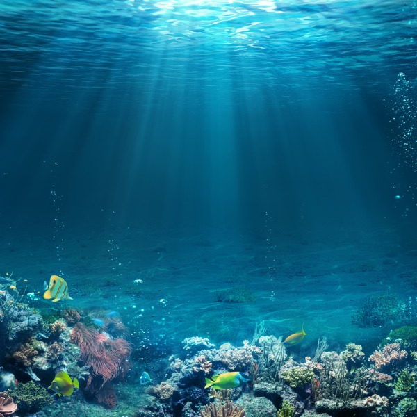
Underwater scene with reef (RomoloTavani, iStockphoto)
Underwater scene with reef (RomoloTavani, iStockphoto)
How does this align with my curriculum?
Learn about the pelagic and benthic zones of oceans.
Follow me on a journey to visit the different zones of the ocean. As we travel, you will learn about two types of zones: the pelagic and benthic zones. Pelagic zones are zones of oceanic waters. Benthic zones are areas of the bottom, or of the ocean. Ready to dive down? Let’s go!
Starting from the coast, we will first need to cross the intertidal zone. This zone varies in size, depending on the. It spans the distance from the highest point on land that waters reach during high tide to the lowest point waters reach during low tide. This means that, depending on the time of day, you could be walking on dry sand or swimming in this zone. You can learn more about tides in this backgrounder about waves, tides and tsunamis.

Image - Text Version
Shown is a diagram of a cross section of land and water of the ocean. The land formations are part of the Benthic Zone and the regions of water are part of the Pelagic Zone.
The topmost Benthic Zone is the Continental Shelf. It extends from the surface to 200 metres. Below this, from 200 metres to 3 000 metres is the Continental Slope. For context, the maxium depth a sperm whale can do down is 1 000 metres. Below this is the Continental Rise which extends from 3 000 to 6 000 metres. For context, the ship Titanic is sitting at 3 800 metres. Below this is the Ocean Basin, also known as the Abyssal Plain. Except for trenches within it, the plain is around 6 000 metres. The deepest parts of the ocean are in trenches which extend down to 11 000 metres. For context, the height of Mount Everest is 8 848 metres. Canadian James Camercon reached a depth of 10 898 metres in 2012.
The topmost layer of the Pelagic Zone is the Epipelagic or Sunlight Zone. It goes down 200 metres. Below that is the Mesopelagic or Twilight Zone. It goes from 200 to 1 000 metres. Below this is the Bathypelagic or Midnight Zone. IT goes from 1 000 to 4 000 metres. Below this is the Abyssopelagic or Abyssal Zone. It goes from 4 000 to 6 000 metres. The deepest part of the ocean is the Hadalpelagic Zone. It is also known as the trenches. It goes from 6 000 to approximately 11 000 metres.
Did you know?
Canada has the longest marine coastline in the world. It is about one third of the world's total coastline!
For the rest of our journey to the bottom of the ocean, you will need to imagine yourself going down in a submarine. First you will need to follow the continental shelf. The continental shelf is the part of a that is underwater. It is broad and descends slowly.
Epipelagic Zone
The Epipelagic Zone, also known as the ‘Sunlight Zone’ is the region of the ocean that sits on the continental shelf. It extends from the surface down to 200 m. The word epipelagic comes from the Greek words epi meaning “at the surfaces,” and pelagikos meaning “of the sea”. This zone is known as the Sunlight Zone because it is in this zone where enough sun rays can penetrate the waters for photosynthesis to occur. The maximum depth for this zone in clear, open ocean water is 200 metres.
In coastal waters, this zone can be as shallow as 50 metres. This is because things like runoff from rivers and strong waves increase the amount of . These tiny particles reflect sunlight, which prevents it from reaching deeper into the water.

Image - Text Version
Shown are two images of light spectrums against black backgrounds. The one on the left looks like a tall, pointy, upside down mountain. It pointiest part is in the pale blue region of the visible light spectrum and the maximum depth this light can reach is 200 metres. The one on the right looks like a small, rounded upside down hill. Its highest part is in the green part of the spectrum and the maximum depth this light can reach is around 50 metres.
In coastal areas, photosynthesis is done mainly by aquatic plants, like algae and kelp, that grow on the bottom. But, photosynthesis by these plants is only a small part of all the photosynthesis done by plants in the Epipelagic Zone. So where is the rest of the photosynthesis happening?
Most photosynthesis in this zone is done by microscopic floating called phytoplankton. These organisms form the base of food pyramids for many diverse aquatic ecosystems such as coral reefs, kelp forests and seagrass meadows. So it should not be a surprise that about 90% of marine life is found in the Epipelagic Zone.
The Epipelagic Zone is also where water temperature can vary the most across the globe. At the surface, water can be as cold as -2 degrees Celsius near the poles. But wait a minute... That is below freezing. How can that be? Doesn’t water freeze at zero degrees Celsius? Fresh water does freeze at this point, but salt water, like that found in oceans, has a lower.

Image - Text Version
Shown is a photograph of the Arctic Ocean near Greenland. Visible is a wide expanse of deep blue water with ice sheets extending up from both the left and right side of the image.
Did you know?
The coldest seawater still in the liquid state ever recorded was found in 2010, in a stream under an Antarctic glacier. Its temperature was −2.6 °C (27.3 °F).
The warmest ocean surface water is usually in the Red Sea. This water can reach over 32 degree Celsius in the summer.
The Epipelagic Zone is the pelagic zone that humans know most about. For one thing, it is the easiest to reach. It is also the zone with the most light and the least pressure.
In the ocean, the exerted by water increases rapidly the deeper you go. Pressure can be measured using different units. The one commonly used in oceanic sciences is the atmosphere (atm). 1 atm represents the average at sea level. Pressure in the ocean rises by one atmosphere (1 atm) for every 10 metres of depth. This means that a diver who is 50 metres below sea level has the equivalent of six Earth atmospheres pressing down on them. Why six? There are five for the 50 meters of water plus one from the air!
Mesopelagic Zone
As you go down further than 200 metres, the environmental conditions become much more extreme. You have now entered the Mesopelagic Zone. Very little visible light makes it down this far, which is why this zone is also known as the ‘Twilight zone’. The Mesopelagic Zone extends from 200 metres to 1 000 metres and has pressure of 20 to 100 atm. This zone is adjacent to the top of the continental slope.
The Twilight Zone is home to a few hardy fish and species, but there are no photosynthesizing organisms here. This means that animals living in the mesopelagic zone largely have two choices for food. Some live on food particles that fall from the epipelagic zone. Others are active predators that can go up into the epipelagic zone to feed.
Near the top of the Mesopelagic Zone, the water can still mix and temperatures vary depending on location. Around 500 to 800 m, though, the water temperature drops off quickly. This phenomenon is called a . Below the thermocline, waters go down to about 2 degree Celsius, but as we go deeper into the ocean, there is little further temperature change. There are some exceptions as we will see as we go deeper and closer to the Earth’s centre.

Image - Text Version
Shown is a line graph of an ocean thermocline. On the x-axis are temperature values from left to right of 4, 8, 12, 16, 20 and 24 degrees Celsius. On the y-axis are depths in metres beginning at zero and increasing in 500 metre increments to 7 000 metres. The line of the graph begins at the upper right at 24 degrees and 0 metres. Between there and 8 degrees, the line gradually slopes down towards the 1 000 metre mark. At this point the line begins to curve down sharply and it reaches a temperature of 4 degrees Celsius by 3 500 metres. The line then continues down towards 1 degree Celsisus as the line approaches the 7 000 metre mark.
Bathymetric maps
Have you ever wondered what the bottom of the ocean looked like? You can get a good idea by looking at a Bathymetric map.
Bathymetric maps look a lot like but instead of showing the height of landforms they show the depth of landforms. Below you can see a colour-coded bathymetric map of the world. Coloured black are the parts of the continents that are above water. The pink-coloured part is the continental shelf. You can see that the shelf is broader in some areas than others. In Canada, the shelf is much larger along the Atlantic coast than the Pacific.

Image - Text Version
Shown is a map of the world. The continents are coloured black. The continental shelf is visible as a pink outline of various widths around the continents. The ocean floor is a medium blue clour which lighens to a pale blue in the deeper parts of the ocean. The deepest parts of the ocean appear as thin, yellow jagged areas bordered in pale green. These are the mid-ocean ridges.
So how do we know how deep the ocean is? We get a lot of measurements from satellites as well as from and. Diving down gives us more accurate information, but it is difficult to do. That is why only about 15% of the bottom of the ocean has been mapped by devices in the ocean itself.
Did you know?
An American geologist and oceanographic cartographer named Marie Tharp helped create the first scientific map of the Atlantic Ocean floor in the 1950s.
Bathypelagic Zone
The Bathypelagic Zone is the part of the ocean that extends from 1 000 metres to 4 000 metres. The name bathypelagic comes from the Greek word bathýs which means “deep.” The temperature here is around 4 degrees Celsius. Sunlight does not reach this zone, which is why it is also known as the Midnight Zone.
Next to this zone, the land transitions from the continental slope to the continental rise. It is called a “rise” because it is a pile of material that has fallen down from the continent above. The bigger pieces that end up in the rise often come from events like earthquakes and landslides. Finer sediments come from natural erosion by waves as well as from surface runoff. In some areas, considered “”, the rise is only a narrow strip. In other areas, it can stretch for many kilometres.

Image - Text Version
Shown is a photograph of a rock slide. Large boulders and pieces of rock have accumulated at the bottom of the hill and further up are accumulations of smaller and smaller pieces.
Abyssopelagic Zone
The Abyssopelagic or Abyssal Zone is the part of the ocean that extends from 4 000 metres to 6 000 metres. The word abyss comes from a Greek word meaning “bottomless.” The temperature here is around 3 to 4 degrees Celsius. This zone covers 83% of the total area of the ocean and 60% of Earth's surface. The water in this zone is extremely cold and has very little oxygen in it. It is also completely dark and under very high pressure. Some people call this zone the desert of the Ocean. Even with all of this, some animals can still be found in this zone.
Next to this pelagic zone, is the Abyssal Plains also known as the ocean floor. This landform covers more than 50 percent of the Earth’s surface. Like plains on land, the Abyssal Plains are very flat. In fact, ths zone is one of the flattest landforms on Earth.
The Abyssal Plains lie on top of the . Like the continental crust, the oceanic crust is part of the lithosphere. However, it is much younger and thinner than the continental crust.
The ocean floor is where tectonic plates meet. When plates slide over, under and against each other it can lead to the formation of mountains, volcanoes, and vents. A group of well known undersea mountains form the mid-oceanic ridge. These formations appear on the bathymetric map as green lines in the center of the oceans.
On the ocean floor we can also find mountain-like features formed from underwater volcanoes. If a is large enough it can even reach the surface of the ocean forming an island. The Hawaiian islands in the Pacific Ocean are an example of volcanic islands.
When tectonic plates pull away from each other, hydrothermal vents can form. Hydrothermal vents are likeon land. They happen when cracks in the ocean floor expose to water. Hot clouds of gases escape the cracks. Black smokers or deep sea vents happen when the magma is closest to the surface. They produce dark clouds, called plumes, which are made of boiling sea water and dissolved minerals containing sulphur. White smokers are cooler vents that tend to be further from hot magma. They are white because they contain dissolved minerals such as calcium and silicon.
Did you know
The temperature around a deep sea vent can reach 450°C.
Another interesting feature that can only be found on the ocean floor are gas hydrates. These are crystal formations made of water and a gas like. While at the bottom of the ocean, it forms a type of ice in which water molecules trap the gas molecules. But once on land it quickly melts and gas is released. You can see an example that was collected and brought up into a ship in the short video clip below.
Did you know?
One cubic metre of gas hydrate under the water expands to roughly 100 cubic metres of gas on land.
Methane hydrates like the ones found along Canada’s coast are also known to bubble. Tiny bubbles rising from the seafloor have been seen with Ocean Networks Canada’s cameras and sonar instruments. Scientists are interested in being able to estimate the total amount of methane that is escaping because some of it can leave the ocean and end up in the atmosphere.
Did you know?
Methane gas has a greenhouse effect more than 20 times more powerful than that of carbon dioxide.
Ready for the Deepest?
If the abysses didn’t scare you, let’s keep going down, where only a few humans have been…
Hadalpelagic Zone
The Abyssal Plains are also home to deep canyon-like features, called trenches. The trenches are home to the Hadalpelagic Zone, also known as the Hadal Zone. The word “Hadal” comes from Hades, the ancient Greek god of the underworld.
The Hadal Zone is not a continuous zone but rather, it includes 13 oceanic troughs and 33 trenches. Both are types of depressions in the seafloor. Troughs tend to be shallower, shorter and narrower than trenches. Trenches are typically 50 to 100 kilometres long and 3 to 4 km deep.
There are five trenches known to be deeper than 10 kilometers. These are the Tonga, Kuril-Kamchatka, Philippine, Kermadec and Mariana trenches. The deepest point in the ocean currently-known is called the Challenger Deep. It is located in the Mariana Trench, in the Pacific Ocean. It is 10 924 metres deep. In comparison, Mount Everest is 8 849 metres high.
Imagine the pressure that a column of nearly 11 km of water has. At 1100 atmospheres (atm), the pressure is more than 70 kilograms per square centimeter. This is the equivalent of having 50 jumbo jets pressing down on you!
The pressure is the main reason why very few people have been able to visit the ocean’s deepest parts.

Image - Text Version
Shown is a colour sonar map image of the Mariana Trench. It looks a bit like a wide bolt of lightning. The depths of the various parts are shown using a spectrum of colours with red being the shallowest and violet being the deepest. There are three main jagged parts of the trench. The furthest to the left is called the "Western Pool" and it was the site of the Trieste dive in 1960. The middle jagged part is called the "Central Pool". It was the site of the Limiting Factor dive #4 in 2019. The jagged part furthest to the right is known as the "Eastern Pool". It is the site of the Deepsea Challenger dive in 2012 and three more LImiting Factor dives in 2019. Each of the dives aimed for the deepest part of each pool.
Did you know?
The Challenger Deep point gets its name from the ship the HMS Challenger. In 1875, its crew found the Mariana trench by exploring the oceans of the world and measuring its depths with kilometres of rope!
To learn more about how people explore the ocean depths, check out our Backgrounder Exploring the Ocean Floor.
Learn More
Fascinating 3D Journey to the Ocean Depths (2020)
This video animation (9:34 min.) takes you on a dive into the deepest areas of the seas.
What’s Hiding at the Most Solitary Place on Earth? (2019)
This video (11:35 min.) animation by Kurzgesagt – In a Nutshell presents the ocean zones and its life forms.
To the continental shelf ... and beyond! (2021)
This video (3:18 min.) from MooMooMath and Science has images and descriptions of the different parts of the ocean floor.
Astonishing Ocean Facts : The Mystery of Hadal Zone. (2020)
This video (9:31) from Big Factz provides a humourous but fact-filled look at the depths of the Hadal Zone.
Robots in the Abyss: 30 years of research on the abyssal plain provides clues to climate change (2020)
This video (6:02) from the Monterey Bay Aquarium Research Institute discuss the Station M laboratory on the Abyssal plains of the Pacific Ocean.
References
DataBayou (n.d.) Ocean Depth Map. Retrieved from https://databayou.com/ocean/depth.html
Oskin, Becky (2017, Dec. 06). Mariana Trench: The Deepest Depths. Live Science. Retrieved from https://www.livescience.com/23387-mariana-trench.html
Woods Hole Oceanographic Institution (n.d.) Ocean Trenches. Retrieved from https://www.whoi.edu/know-your-ocean/ocean-topics/seafloor-below/ocean-trenches/