Human Exploration of the Deep Ocean
Remotely operated underwater vehicle (ROV) (undefined undefined, iStockphoto)
Remotely operated underwater vehicle (ROV) (undefined undefined, iStockphoto)
How does this align with my curriculum?
Learn about how humans explore the deep ocean and what they have learned.
Humans have always been fascinated by the ocean. From sailing around the world to diving into the depths, we are constantly searching for new ways to uncover the mysteries of life under water. Let’s explore the innovations that made it possible to explore some of the deepest parts of the ocean where even sunlight cannot reach.
Come on, jump in! The water is fine.
Did you know?
In 1521 Portuguese explorer Ferdinand Magellan tried to determine the depth of the Pacific Ocean. Far from shore, he dropped a cannon ball attached to a rope into the ocean. When, at 732 metres, it had still not hit bottom, Magellan declared the ocean “immeasurably deep”. We still use a similar process today to measure the depth of water. It is called depth sounding.
Exploring with Submersibles
Deep ocean exploration is a tricky task. Once you go deeper than 200 metres, the ocean gets very dark and very cold. The also greatly increases. All of these factors make it difficult for people to spend time there. Humans exploring the deep ocean need a special kind of vehicle known as a .
There are two main types of submersibles.
Crewed Vehicles
Crewed vehicles, also known as human-occupied vehicles, are similar to . Unlike submarines, crewed submersibles cannot drive on their own. They also usually only have room for a few people.
Rather than travelling around, crewed vehicles mainly bring a small group of people down into the ocean depths and then back up again. They usually have lights, cameras, sensors and collection arms for making observations and gathering data.

Image -Text Version
Shown is a black and white photograph of the deep sea submersible Trieste being lifted out of the water. The submersible is mainly cylindrical. A large sphere is attached to its lower hull. A large flat triangular rudder is at the lower rear of the submersible. The submersible is hanging from two wires connected to its top. The submersible is white with vertical black stripes. The sky and sea behind it are grey.
Did you know?
Challenger Deep is the deepest part of the Mariana Trench. It is 11 km below the surface of the ocean.

Image - Text Version
Shown is a labelled diagram of the interior of the deep sea submersible Trieste. The submersible is shaped like a long trapezoid with a circle at the bottom that serves as the crew area. The rudder is a smaller trapezoid at the bottom left of the submersible. The propellers are at the top left of the submersible. The diagram also shows water ballast and fuel tanks on both sides of the submersible and iron pellets in the centre.
To withstand the great pressure, the two-man crew sat in a sphere with 12.7 cm (5”) thick steel walls. They were able to look through a single plexiglass window. Magnetic iron pellets were used as . These kept the submersible upright. To go down, they could let in some water to the water ballast tanks. This made the submersible heavier, so it would sink. When they were ready to go back up, they could release some of the pellets as well as release some of the water from the water ballast tanks. To help the submersible float back up, the Trieste had tanks filled with aviation fuel. Like air, the fuel was lighter than the surrounding water. Fuel was used instead of air because it would not be compressed by the intense pressure. Propellers let them push the submersible forward and a rudder let them steer the submersible. Flood lights near the window let them see the ocean around them.
Would you have volunteered for this mission?
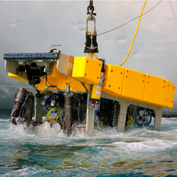
Uncrewed Vehicles
Uncrewed vehicles do not carry any passengers. These robotic vehicles can either be controlled remotely or are programmed to operate on their own similar to . Uncrewed vehicles are often attached to a boat on the surface using a long cord. Uncrewed vehicles are smaller than crewed vehicles. This allows them to get into smaller spaces, such as trenches or underwater caves. Like crewed vehicles, uncrewed vehicles are also equipped with lights, cameras, sensors and collection tools.

Image - Text Version
Shown is a remotely controlled uncrewed vehicle near a coral reef. The vehicle is floating to the right of a coral reef. It is a yellow cylinder with a cable going from behind it up to the water surface. There is also a light shining out from the centre of the vehicle. The water surrounding the vehicle is teal with sunlight shining through it. The coral reef has corals of many different colours and textures protruding off of it.
Exploring with Technology
Besides submersibles, scientists have other types of technologies for studying the deep sea and the ocean floor. One type of technology is a network of cables that runs along the ocean floor. Ocean Networks Canada has two of these networks off the west coast of Canada.

Image-Text Version
Shown is a map of the NEPTUNE network. It is a circular network extending along the Pacific Seafloor off of the west coast of Vancouver Island, British Columbia. A dotted line connects the network to the University of Victoria.
The cable networks have dozens of cameras, hydrophones and seismometres that collect data about the ocean. With these tools, scientists can measure the ocean’s temperature, , as well as the movements of Earth’s crust below the ocean. Think of it as a heart-rate monitor for the ocean!

Image - Text Version
Shown is a colour photograph of a freshly drilled ice core. The ice core itself is a long, translucent white cylinder. It is sitting on a long metal shelf that is slightly wider and taller than the ice core. The shelf is support by brackets to the top of a wooden table.
This includes what plants and animals lived there in the past as well as climate and environmental changes. By looking at the past, we can more accurately predict the future.
Many amazing things have been found through ocean drilling. Perhaps one of the most fascinating is that were found to live over one kilometre beneath the sea floor. This finding suggests that there is unknown life within the of the ocean floor. These microorganisms can give us clues as to how creatures live under extreme conditions.
What We Have Discovered
Pollution
By exploring the depths of the ocean, scientists have uncovered many human impacts. For example, people long thought that the deep sea was void of all life. This made it a good place to get rid of their nuclear waste, or so they thought. Deep ocean exploration showed that the deep ocean was actually filled with life. This led to a ban on nuclear waste disposal in oceans in 1994.

Image-Text Version
Shown is an illustration of drums of nuclear waste on the ocean floor. Two drums are shown. Both are grey cylinders. A hazardous nuclear waste icon is visible on the front drum. Green bubbles are coming out of these drums. Both drums are sitting on a green sea floor with small hills. Corals, fish, and a jellyfish are visible around the nuclear waste.
Did you know?
The London Protocol prohibits all dumping of wastes and other matter into the sea, except for those on an approved list. It has been in force since 1975.
The ocean is also a global dumping ground for trash. Have you ever heard of the Great Pacific Garbage Patch? This floating collection of waste is located in the pacific Ocean between Hawaii and California and is 1.6 million square kilometres in size. That is three times the size of France! Most of this garbage will eventually sink down to the ocean floor and pollute marine habitats. Explorers were not too thrilled to find a plastic bag at the deepest point in the ocean.
Climate Change
Exploring the ocean helps scientists learn a lot about the impacts of climate change on our planet. For example, exploring the deep sea has taught us how the ocean captures carbon. This is an essential factor in limiting climate change.
The ocean is also the largest habitat on the planet! Scientists are constantly discovering new forms of life underwater. We are only starting to understand the level of biodiversity that exists in the deep ocean! Unfortunately, ocean warming and acidification due to climate change threatens ecosystems across the planet, including in the ocean. Organizations around the world, such as Ocean Networks Canada, are working to better understand the threats to ocean ecosystems using submersibles and fixed stations to record all sorts of data.
Humans have been exploring the ocean for hundreds of years, but we still have so much to learn from the oceans. If you want to explore the ocean yourself from the comfort of your home, check out the videos from the crew of the submersible Nautilus or one of the Ocean Live Cams from Explore.org.
Who knows what you might discover!
Learn More
The Great Pacific Garbage Patch
Interactive website from The Ocean Cleanup with information on the Great Pacific Garbage Patch.
Ocean Exploration
Timeline from SeaSky.org detailing significant moments in ocean exploration.
Science & Technology: Exploration Tools
Interactive webpage with images and descriptions of different tools used to explore the ocean from the NOAA.
Ocean Technology Glossary of Terms
Glossary of terms for various important ocean exploration tools and methods from Ocean Networks Canada.
Core Sampling - French oceanographic fleet
Webpage detailing how scientists take samples of ocean cores for research purposes.
References
IODP. (n.d.) About. IDOP Canada.
Jarvis, O. (Feb 25, 2016). 6 of the Most Influential Deep-Sea Expeditions. Underwater 360.
Lafee, S. (Jan 16, 2010). Trieste took two men to world’s deepest site. The San Diego Union-Tribune.
National Geographic Society (n.d.) Great Pacific Garbage Patch. National Geographic.
National Geographic Society (n.d.) Ocean Exploration: Timeline. National Geographic.
NOAA. (n.d) Submersibles. Ocean Exploration.
Ocean Networks Canada. (n.d.) Science.
Wikipedia. (2021) Challenger Deep.