Weather: Clouds
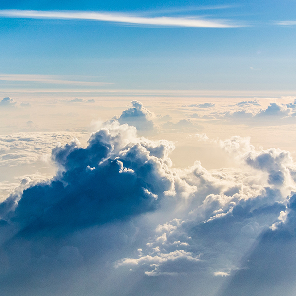
Clouds seen from an airplane (Kaushik Panchal, Unsplash)
Clouds seen from an airplane (Kaushik Panchal, Unsplash)
How does this align with my curriculum?
Learn how clouds form and how they can be grouped into different categories
Clouds are made up of water droplets or tiny ice crystals.
As part of the water cycle, water evaporates from oceans, rivers and lakes. This water rises up into the atmosphere. The farther up it travels, the colder the air around it gets. When the air gets cold enough, the water starts to condense around small particles of dust and pollen in the air. This condensation creates visible clouds.
Did you know?
Although clouds float in the air, they can still be very heavy. A single cumulus cloud can weigh hundreds of tons!
Clouds are classified by shape and altitude. Clouds often have two-part names that describe both these features.
Most clouds form in the troposphere. That’s the lowest layer of the Earth’s atmosphere. The height of the troposphere varies depending on where you are on Earth. The average height at the Equator is 18 km (11 mi; 59,000 ft). The average height at the north and south poles is 6 km (3.7 mi; 20,000 ft). We’ll use measurements based on the height of the troposphere in an area between the Equator and the poles.
Locations of Clouds
Clouds can be grouped based on the altitude where they form.
- Low-level clouds form at an altitude of less than 2 000 m. This group includes stratus, cumulus, stratocumulus and cumulonimbus clouds. Although they form below 2 000 m, some low-level clouds can grow very tall. The tops of cumulonimbus can reach an altitude of up to 20 000 m!
- Mid-level clouds form at an altitude between 2 000 m and 7 000 m. This group includes altocumulus, altostratus and nimbostratus clouds.
- High-level clouds form at an altitude between 5 000m and 13 000 m. This group includes cirrus, cirrocumulus and cirrostratus clouds.

Image - Text Version
Shown is a colour diagram of ten types of clouds above a landscape. Along the left edge is a scale. From the bottom, this is marked “Low” (0-2 000 m), “Mid” (2 000-7 000 m) and “High” (7 000-12 000 m). The cloud on the left edge stretches from just above the horizon (about 1 000 m) to almost 10 000 m. This is the tallest cloud in the image. It is anvil-shaped at the top, and has a dark bottom where rain is falling onto the grass below. This is labelled “Cb: Cumulonimbus.” The cloud on the right edge is shorter and wider than the cumulonimbus. It is dark grey and stretches from just above the ground to almost 7 000 m. Rain falls all around it. Between these two large clouds are eight much smaller clouds in different shapes. In the low section are three white clouds. The first has a round fluffy top and a flat bottom. This is labelled “Cu: Cumulus.” The second is several long, thin wisps. These are labelled “St: Stratus.” The third is long and puffy. It is labelled “Sc: Stratocumulus.” In the mid section are two sets of white clouds. The first is two parallel lines of small puffs. One of these is labelled “Ac: Altocumulus.” The other is long, thin and wide. This is labelled “As: Altostratus.” The high section has three sets of white clouds. The first four parallel lines of tiny puffs. These are labelled “Cc: Cirocumulus.” The second is thin and flat with wavy edges. This is labelled “Cs: Cirrostratus.” The third is a group of curved, feathery wisps. These are labelled “Ci: Cirrus.”
Did you know?
Along with the height of the troposphere, cloud heights vary in different parts of the world. In warmer regions near the equator, the top of the troposphere is much higher. As a result, clouds form much higher in the sky!
Shapes of Clouds
Based on their appearance, most clouds fall into ten types in four categories.
Cirro-form
- From the Latin word for hair. These are thin, wispy, high-level clouds. They include:
- Cirrus clouds, which are delicate, feathery, and always made of ice. They light up in yellow or red before sunrise and after sunset.
- Cirrocumulus clouds are grainy or ripply and made mostly of ice. They appear in thin, patchy rows and don’t last long in the sky.
- Cirrostratus clouds are also made of ice crystals. They appear in a thin sheet that seems to cover the sky. You can usually see the Sun through these clouds.

Image - Text Version
Shown are three colour photographs of different thin, wispy clouds, arranged in a row. The left image shows feathery white clouds in diagonal streaks across deep blue sky. The centre image shows a thin layer of tiny white puffs, also in diagonal streaks across deep blue sky. The right image shows a thin, translucent veil of white across deep blue sky.
Cumulo-form
- From the Latin word for pile, these look like puffy white cotton balls with flat bases. They can stretch high up into the atmosphere. They include:
- Cumulus clouds can look like domes or towers in the sky. They can be made of ice crystals, water droplets, or both. Many people call them fair weather clouds.
- Stratocumulus clouds are grey or whitish and appear in a patchy sheet across the sky. They are usually made of water droplets, but sometimes include ice crystals. They usually have a dark honeycomb, or lumpy or rolled texture.
- Altocumulus clouds appear in white or grey patchy layers of round shapes or rolls. They can be made of water droplets or ice crystals. You often see them with other types of clouds, and they can cause coronas around the Sun and Moon.

Image - Text Version
Shown are three colour photographs of three different types of fluffy white clouds, arranged in a row. The left image shows a large white puffy shape with a dark bottom. In the background is a bright white cloud that looks like a tall building, with an anvil shape extending from the roof. The centre image shows white puffy scattered in a thin layer across deep blue sky. The right image shows smaller white puffs spread more thinly across greyish blue sky.
Strato-form
- From the Latin word for layer, these are widespread and can look like a blanket. They include:
- Stratus clouds are flat and greyish. They can be made of water droplets, ice crystals, or both. They extend over large sections of the sky and sometimes bring drizzle or light snow. When stratus clouds touch the ground they are called fog.
- Altostratus clouds appear in a grey or bluish sheet that covers the entire sky. They are made of a mixture of water droplets and ice crystals and sometimes bring light precipitation. You can see the Sun through these clouds, but it often appears blurry.

Image - Text Version
Shown are two colour photographs of different types of smooth, translucent cloud over landscapes. The left image shows a sheet of light grey clouds that is uniform across the sky. It fades in the lower half of the image to reveal a town in a green valley, shrouded in fog. The right image shows the whole sky as pale grey with a few soft streaks of darker grey. Below, there is no fog around trees, buildings and power lines.
Nimbo-form
- From the Latin word for rain, most precipitation comes from nimbo-form clouds. They include cumulo, cirro and strato forms, and they are generally the thickest type. They include:
- Nimbostratus clouds form when altostratus clouds get thick and dark enough to blot out the sun. They are mostly made of water droplets, but can also contain ice crystals. They often bring rain or snow.
- Cumulonimbus clouds form heavy, dense towers. They are often anvil-shaped, with very dark bottoms. They are made of water droplets and ice crystals. These clouds are responsible for thunderstorms, lightning, hail, and even tornadoes.

Image - Text Version
Shown are two photographs of different types of clouds over dark landscapes. The top half of the left image is dark grey. The grey spills down in wisps across a light greyish sky below. Along the bottom edge of the image, trees are in a dark silhouette along the horizon. The right photograph is dominated by a white puffy anvil shape against a dark blue sky. Below, the base of the cloud darkens so much it almost disappears. A few trees and power lines can be seen in a dark silhouette along the bottom edge of the image.
Did you know?
“Contrails” is short for “condensation trails.” At high altitudes, cold air temperature causes water vapour to condense around the particles in hot, humid airplane exhaust. This creates the line-shaped clouds you see in the sky.
So the next time you look at clouds, see if you can figure out what type they are!
Learn More
How do clouds form?
This article, with video, shows how clouds form.
What Are the Different Types of Clouds? (2020)
This video (2:55 min.) by NOAA SciJinks, explains the different types of clouds, and how they can be used to predict weather on Earth.
How did clouds get their names? - Richard Hamblyn (2015)
This video (5:06 min.) by Ted-Ed tells the story of how Luke Howard first classified clouds, and how his work influenced poets, painters and scientists.
Why Do Clouds Stay Up? (2014)
This video (6:28 min.) by Be Smart explains how clouds form, how they stay in the air, what’s inside them, and how they look from space.
References
Braun, S. (n.d.). What are clouds made of? Are they more likely to form in polluted air or in pristine air? NASA.
Encyclopaedia Britannica. (2019, March 18). Cloud.
UCAR Center for Science Education. (2012). Cloud types.
Zuckerman, C. (2019, April 24). Clouds, explained. National Geographic.