Deciding Where to Dig: Geology and Mining
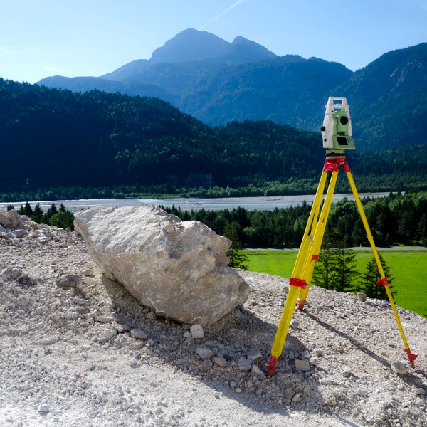
Geological surveying equipment (KingMatz1980, iStockphoto)
Geological surveying equipment (KingMatz1980, iStockphoto)
How does this align with my curriculum?
Learn about how mining companies find good locations for mining.
Introduction
We define mining as the process of extracting useful materials from the Earth. But what are these useful materials and how do we get them?
The useful materials we are talking about are minerals. The Earth has more than 3 500 different kinds of minerals. Minerals we mine include gold, copper, iron, or uranium. We use these minerals everyday for many things. This includes computers, vehicles, buildings and more.
We get these useful minerals from mines. But how do people know where to put mines if the minerals are buried underground? This is an important question for mining companies.
Looking for Minerals
Exploration is the name of the process for looking for minerals. In this step, scientists use information from the Earth to look for evidence of the minerals they want. This step must happen before people can start mining.
The minerals that people mine are often found with certain types of rock. We call rock containing minerals ore. When we find a large amount of ore-containing rock in one place, we call it a deposit.
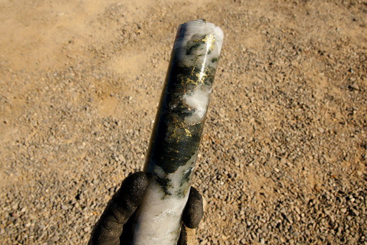
Image - Text Version
Shown is a colour photograph of a cylinder of black and white rock squiggled with lines of gold.
A hand in a black glove is holding the cylinder above ground covered in dry brown soil.
The cylinder is long, thin, and shiny. The rock it's made from is mostly white, with blobs of black and dark grey around the top half. The darker rock has thin lines and splashes of gleaming gold throughout.
Geophysical Surveying
Mining companies can use geophysics to measure certain properties. Geophysics is the study of physical properties of the Earth. This includes studying the Earth's gravitational, magnetic and electrical fields. Geophysicists conduct surveys of these fields so they can create images. They usually measure these fields at the Earth's surface with special instruments. They also sometimes put these instruments onboard aircraft.

.png)
Image - Text Version
Shown is a postage stamp with Cyrillic text and an illustration of work above and below ground.
An English translation of the text reads, "USSR stamp: Controlled Explosion at Reflection Seismology and Aeromagnetic Survey. Series: 50th First Soviet Geology."
The illustration is in shades of red and white, in a jagged rock shape in the centre of the stamp. The picture is divided in half - above and below ground.
Above, white arched lines radiate down to the ground from an airplane in the sky. On the ground are two trucks and a tower made of metal beams. In the background are white peaks of a mountain range.
Below ground, a white burst explodes at the bottom of a narrow hole in the top left corner. Dashed white arrows extend from this, bouncing off the layers of rock around, and back to the surface. The layers of rock are depicted as different sizes of bricks in pink, red and black.
Gravity surveys measure the differences in the Earth's gravitational field. Different gravitational measurements are caused by rocks of different density. For example, uranium deposits are much denser than the rock around them. In a similar way, magnetic surveys measure the differences in the Earth’s magnetic field. The variations provide information about different rock types and the Earth's crust.
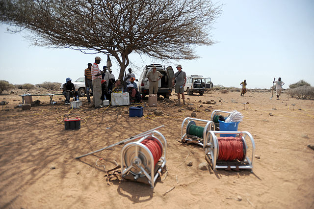
Image - Text Version
Shown is a colour photograph of reels of cable and batteries on dry soil.
In the foreground are four large reels of electrical cable. In the middle ground are two large car batteries. In the background, eight or nine people are gathered around a wide brown tree with no leaves.
The landscape appears dry, with flat, pale brown soil, small brown shrubs, and pale blue sky.
Using these properties of the earth, geophysicists can begin to narrow down where to dig for mineral deposits.
Geological Surveying
Other surveys and methods are also done using geology. Geology is the study of the Earth, its history, materials, and processes. Geologists are the scientists who study those aspects of the Earth. A geological survey is a detailed investigation of the geology below a specific piece of ground.
The investigation of an area may begin with mapping the visible rock formations. Exposed rock which is not covered by soil we call an outcrop. Outcrops of rock provide valuable information to geologists. They are also easy to access because they are not buried below ground.
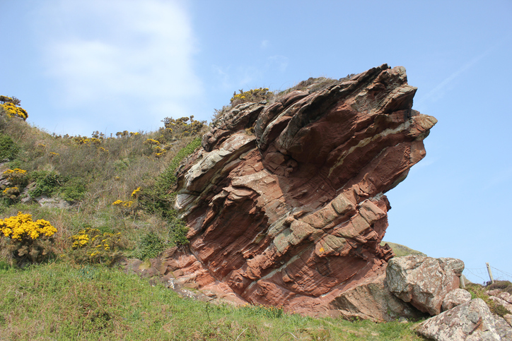
Image - Text Version
Shown is a colour photograph of reddish brown rock sticking out of green grass.
The rock has parallel striped layers and a soft texture. It extends diagonally up from the side of a hill. The sky behind is pale blue with a wispy cloud. The hill in the foreground is covered in green grass dotted with yellow flowers.
While a geologist is mapping rock outcrops, samples of rock are also collected. These samples help determine if the rock contains mineral deposits. Samples collected on the surface of the ground can include pieces of rock, samples of soil as well as sediments.
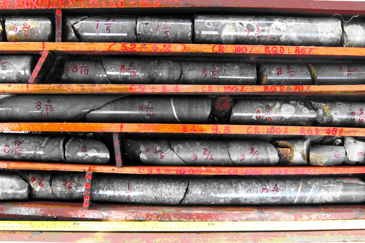
Image - Text Version
Shown is a wooden crate filled with cylinders of grey rock.
The camera looks straight down at a large wooden box divided into long, thin compartments. Each compartment is filled with a long, shiny cylinder of grey rock. Some cylinders are mottled with pale grey, or veins of white. Some are cracked into several pieces, but others are whole. The edges of the wooden dividers between the rocks are labelled with series of bright red letters and numbers.
Geologists will look in detail at the core samples and describe the rock. These descriptions include valuable details about rock formations and the minerals found there. Small samples are also taken from the core samples and sent to a lab to be analysed. Surface samples are sent to the lab as well. Together these samples will provide information about the mineral deposits in the area.
Back at the Lab
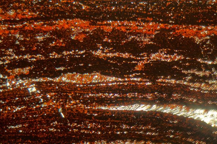
Image - Text Version
Shown is a colour photograph of the magnified texture of iron ore.
The whole image is filled with wavy horizontal stripes in shades of reddish brown, orange and gold. The material has a rough, grainy texture, and the gold areas seem to sparkle.
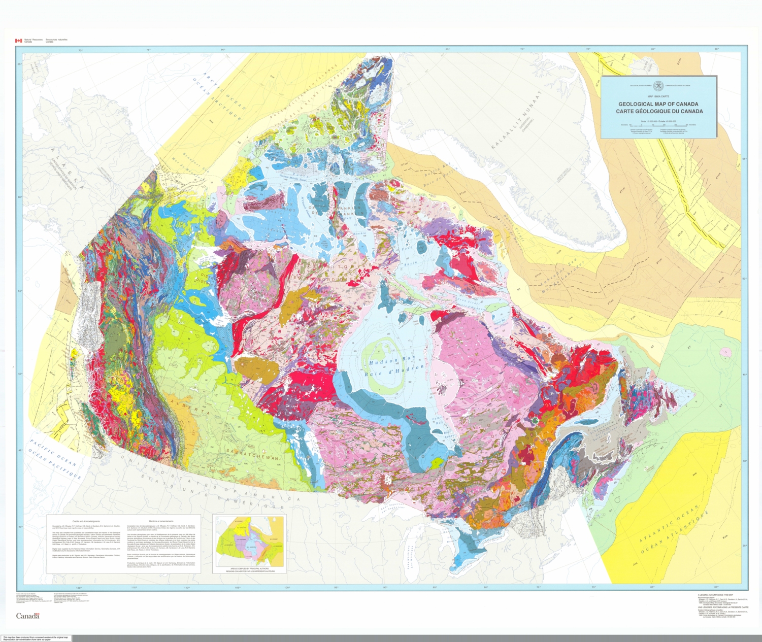
Putting it all Together
Geologists use the information collected from the surveys and samples to make geological maps. These maps help mining companies find the best places for mines.
Image - Text Version
Shown is a map of Canada, overlaid with strokes, blobs and splashes of bright colour.
The title of the map is in black letters in a blue box in the top right corner of the map. Other information is printed along the bottom edge, too small to read. No legend is visible, to explain what each colour means.
The west coast is dense with narrow bands of red, blue, green, and yellow. The prairies are wide areas of pale green and yellow. The arctic region is pale blue and green. A wide region all around Hudson's Bay is mostly pale pink, with thin stripes of red, purple and gold. The southern shore of Hudson's Bay is shown as bands of light and dark blue. Southern Ontario, Northern Québec and Labrador are orange, gold and red. Southern Québec and New Brunswick are pale and dark blue. Nova Scotia and the Island of Newfoundland are mottled with grey, pink, blue and red.
The oceans around Canada are shown in paler colours. The Atlantic is stripes of pale green, yellow and gold. The Arctic is gold and orange. The Pacific is pale yellow and gold.
Geologists will also analyse the data to determine which areas had the most minerals of interest. Information from the lab will tell them about the percentage of the mineral within the ore. We call this percentage the grade. The higher the grade, the better.
By this stage, geologists and exploration companies will have a good idea of how large the deposit is. They will also have a sense of whether the location is worth mining and how much money the mine could bring in.
Even though many locations are explored, only the most promising locations are mined. The material is taken out of the ground, processed in plants, and used in our everyday lives.
While the world needs materials from mining, it is important that mining is done in a sustainable way. It is the responsibility of both local governments and mining companies to reduce carbon emissions, cause as little disturbance as possible, properly process mining waste, and be as environmentally conscious as possible.
Let’s Talk Science appreciates the work and contributions of Andrea Nielsen from Orano Canada in the development of this Backgrounder.

About Orano Canada
Headquartered in Saskatoon, Saskatchewan, Orano Canada Inc. is a leading producer of uranium, accounting for the processing of 12.2 million pounds of uranium concentrate produced in Canada in 2021. Orano Canada has been exploring for uranium, mining and milling in Canada for more than 55 years. The company employs about 420 people in Saskatchewan, including about 300 at the McClean Lake operation where over 49% of employees are self-declared Indigenous. As a sustainable uranium producer, Orano Canada is committed to safety, environmental protection and contributing to the prosperity and well-being of neighbouring communities. Visit Orano at www.oranocanada.com or follow us on LinkedIn, Facebook and Twitter: @oranocanada
Learn More
Alberta Geological Survey
The Alberta Geological Survey data portal has many different types of geological maps for the province of Alberta
Geophysics
This page on the Academic kids encyclopedia is about geophysics. It has links to many other areas of geology as well.
https://min4kids.org/
Learn more about rocks and minerals, how to identify them, and how they are used.
References
Britannica (n.d.) Prospecting and Exploration.
Lumen Learning (n.d.). The Composition and Structure of Earth.
National Geographic (n.d.). Erosion.