Waves, Tides and Tsunamis
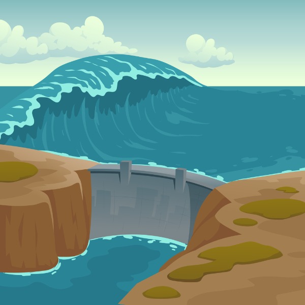
Sea landscape with dam and waves (klyaksun, iStockphoto)
Sea landscape with dam and waves (klyaksun, iStockphoto)
How does this align with my curriculum?
Learn about ocean waves and how they can form tsunamis and tidal waves.
You have probably seen waves on a body of water. But have you ever thought about what waves actually are? Waves are a special type of energy transfer.
- Electromagnetic waves transfer energy through vibrations in electric and magnetic fields.
- Sound waves transfer energy through the vibration of particles of air, water and other solids.
- Water waves transfer energy through the vibration of water molecules.
In this backgrounder, we are going to be taking a closer look at waves in water.
Water waves can take many forms. There are internal waves that happen deep underwater. We don’t tend to see these waves at the water’s surface. There are also surface waves that occur on the surface of water. These are the waves that you are probably familiar with. Some of these surface waves may be tidal waves, which are caused by tides. There are also giant surface waves called tsunamis. In this background we will focus on the science of surface waves.
Wind-generated Waves
Waves can be measured and described according to three characteristics. These include:
- Wavelength, which refers to the distance between wave crests;
- Amplitude, which is the height of the wave from the resting point called the equilibrium;
- and period, which is the time in between crests.

Image - Text Version
Shown is an illustration of blue water waves with labels to indicate the parts of wave systems.
The distance between two highest parts of the waves is labelled as the wavelength. This same distance is also labelled as the period. A clock icon indicates that the period is a measure of time.
A line is draw that shows the intermediate location between the highest and lowest parts of a wave. This is labelled as the equilibrium.
The highest part of a wave is labelled as a crest. The lowest part of a wave is labelled as a trough. The distance between the highest (or lowest) part of a wave is labelled as the amplitude of the wave.
Most surface waves happen because kinetic energy from moving air is transferred to water. These waves can range from small ripples to waves big enough to surf on and everything in between.
The size of wind-generated waves depends on five factors. These include:
- The speed at which the wind blows;
- The distance over which the wind blows. This is called the fetch;
- The width of the area affected by the fetch;
- The amount of time that the wind blows over the given area; and
- The depth of the water.

Image - Text Version
Shown is an illustration of a region of ocean that is labelled with the factors that affect the size of wind-generated waves.
At the top of the image, is a swirl beside the label for wind speed. In the centre of the image, are wavy stripes of paler and paler shades of blue. Above these is the label "depth".
The stripes of blue are bordered on the left and right by arrows which point towards a pale sand-coloured shoreline. These arrows are labelled as the fetch.
The distance between the arrows indicating fetch are two more arrows that indicate that wave are affected by the width of water affected by the fetch.
To the right of the fetch area is a clock icon that indicates that the time the waves travels also affects the size of waves.
Some waves can get very large! Let’s look at two types of these waves and what makes them happen.
Did you know?
The Beaufort scale is a way sailors describe wind and sea conditions. You can learn more about it in our article about wind.
Rogue Waves
Rogue waves are large waves that occur far out at sea. Some happen as a result of storms but others do not. This makes them very hard to predict. For a long time, people were not able to prove the existence of rogue waves even though they believed them to be the cause of many shipwrecks. It wasn’t until fairly recently that scientific research was able to finally prove that rogue waves exist using satellite imagery. Using radar images from the European Space Agency, satellites found ten rogue waves, each 25 metres (82 ft.) or higher.
Did you know?
Rogue waves are also known as freak waves, monster waves, killer waves and extreme waves.
Let’s start by looking at what happens when two waves head towards each other.
As you can see, when two waves meet, they can either add together to make a crest twice as high or cancel each other out. Scientists knew about , but what they could not understand was how rogue waves could become more than twice the amplitude of waves in the area. What was even stranger was that they sometimes occurred where the sea was calm.
Try this!
Make your own waves using this introductory wave simulator and then explore what happens when you have two waves using the interference simulator.
What scientists did to try to explain rogue waves was to find a way to reproduce them in the lab. They were able to do this, and found some interesting results. They discovered that it takes a rare and unique combination of forces from winds and ocean currents to make a rogue wave. Even though they are rare, scientists have found that rogue waves are still much more common than predicted.
In a similar way, rogue holes can form in the ocean. They are the opposite rogue waves. In a rogue hole, the water level is lower by twice the normal average height. Just like rogue waves, rogue holes are very dangerous for ships.
Tsunamis
Tsunami is a Japanese word meaning ‘harbour wave’. This type of surface wave is not caused by wind. Tsunamis are a series of massive waves generated when a large amount of water is vertically. Any event, such as an earthquake or underwater volcanic eruptions can lead to a tsunami.
Earth’s crust is made of massive slabs of rock many kilometres thick. These slabs, known as tectonic plates, may shift and move over time, causing earthquakes. When the plates move upward, they in turn push the water above them upward. At the same time, gravity is pushing downward on the water. These opposing forces create waves. Volcanic eruptions, landslides and meteorite impacts can also cause tsunamis in a similar way.

Image - Text Version
Shown is an illustration of a cross-section of ocean and shoreline with labels that indicate things associated with tsunamis.
At the bottom of the image is a pink section that is bordered on the top by a thick, dark gray area. This is labelled as a tectonic plate. Two such tectonic plates meet in the image. The one on the left looks like it is dropping below the one on the right. At the place where they meet is a white circle surrounded by thin parallel white circles. This symbol is used to indicate the location of an earthquake. This is also labelled with text.
Above this is an area coloured in blue to represent the ocean. In the area of water directly above the location of the earthquake, is a white arrow pointing upwards beside text indicating that the moving tectonic plate is pushing the water upwards. Beside this is another white arrow pointing downwards. This arrow, and the text beside it, indicates the direction of gravity acting on the ocean.
At the top of the water area are waves. The waves have a longer wavelength further from the shore and shorter wavelengths closer to the shore. These are labelled with arrows. The wave have a smaller amplitude further from the shore and a larger wavelength closer to the shore. The amplitude for one wave is labelled.
Also at the top of the water waves are two large white arrows. One is pointing towards shore and one is pointing away from shore. These two arrow indicate the directions that waves after an earthquake.
Tsunami waves are different from the wind-generated waves you can typically observe at the beach. Far out at sea, tsunami waves are hardly noticeable. Their amplitude is small and they have much longer periods and wavelengths. For example, in the open ocean, tsunami wavelengths may be a hundred kilometres long with periods of an hour. Normal waves have wavelengths around 100 metres with periods of a few seconds.
Did you know?
Japanese people call Tsunamis ‘harbour waves’ because they only see these waves when they get closer to land.
In the deep, open ocean, the energy of a tsunami is spread out over a large area and volume of water. As the waves go from deep to shallow waters, their amplitude increases. This is called shoaling. Shoaling happens because the energy of waves is transferred to a smaller volume of water. Once the waves reach the ocean floor, they slow down. But their energy is not lost. The energy is instead used to make their amplitude even greater. By the time the waves reach land, a powerful tsunami may be up to 10 to 20 metres in height!

Image - Text Version
Shown is a colour photograph of a Tsunami Hazard Zone public sign on a wooden post. Palm trees can be seen in the distance behind the sign.
There is an illustration on the sign that has a bright blue background and a white silhouette of a large wave on the left, and a person climbing upwards on the right side. Below the illustration is the text "In case of earthquake go to high ground or inland".
Also, an earthquake tends to happen just before a tsunami. Earthquake tremors travel more quickly through the earth than through the water. This means that when people living in tsunami-prone areas feel an earthquake, they can move to higher ground. Unfortunately, there isn’t always time to do this.
Luckily, large tsunamis happen very rarely. In Canada, the biggest tsunami ever recorded was in 2007, when a 38 metre high tsunami happened after a landslide in Chilliwack, British Columbia. Thankfully it happened in the winter and no one was hurt. This was not the case in 1929 when an Earthquake caused a 13 metre high tsunami in Grands Banks Newfoundland. 25 people were killed and many buildings and houses were destroyed.
Not just big…MEGA!
Some tsunamis have wave heights that are much larger than regular tsunamis. These are sometimes Megatsunamis. The tsunamis discussed above were caused by earthquakes and undersea volcanic eruptions. Known megatsunamis have been caused by large scale landslides and impact events, such as the collision of a meteorite or asteroid with the Earth. This is the case of the asteroid which created the Chicxulub crater and probably caused the dinosaur extinction in Yucatán about 65 million years ago. Scientists think it generated megatsunamis as high as 3 000 metres!

Misconception Alert
People sometimes call tsunamis tidal waves. Tsunamis are not created by tides and they are much less predictable than waves associated with tides.
Tides
If you have been to a beach near an ocean, you may have noticed that sometimes the water comes further up the beach at some times of day. This rise and fall of sea levels is known as the . When the water is at its highest level, it is called high tide. When the water is at its lowest level, it is called low tide. In between, the water is either slowly rising or slowly falling.
Tides are basically very, very long ocean waves with a wavelength that may be as long as half the planet. This is why they are also known as Tidal waves.
This incredible pushing and pulling of ocean water is caused by exerted by the Sun and the Moon. The Sun’s gravity is stronger than the Moon’s, but the Sun is 400 times farther away from the Moon. This is why lunar tides are twice as strong as solar tides.

Tides for one lunar day (Let’s Talk Science based on an animation by the US National Oceanic and Atmospheric Administration).
Animation - Text Version
Shown is a frame animation of the Earth and Moon as well as tide levels near a rocky shore.
There are 24 frames. One for each hour of the day. Over each hour, the Earth rotates to the left. A blue line on the Earth helps to show the movement, similar to the hands on an analogue clock.
An illustration of the Moon is also shown. It starts off directly above the image of the Earth. A gray line connects the Moon and the Earth. The Moon is circling the Earth, moving slowly to the left and downwards.
Below the Earth is text to indicate the time for each frame of the animation.
At the bottom of the frame is a section shaded blue to represent the ocean. To the right of this is a shape that represents land. Over the first 6 hours, the level of the blue arrow goes down. After 6 hours and 12.5 minutes , the water is labelled as low tide. After this, the level of water begins to rise. After 12 hours and 25 minutes , the water is labelled as high tide. Low tide occurs again at 18 hours and 37.5 minutes and high tide occurs again at 0 and 24 hours.
So how do lunar tides work?

Image - Text Version
Shown is an illustration indicating the locations of stronger and weaker gravity on Earth as a result of the Moon.
In the centre of the image is an illustration of a top down view of the Earth. To the right of the Earth, in a line with the centre of the Earth, is an illustration of the Moon. A thin pink line cuts across both the Earth and the Moon.
Surrounding the Earth are drawings of small, black arrows. The arrows indicate the direction of the gravitational field. Near the top and bottom of the Earth, the arrows are pointing towards the Earth. These arrows indicate that the gravitational pull towards the Earth is strongest at these locations.
Near the left side and right side of the Earth, the arrows are pointing away from the Earth. In between, the direction of the arrow gradually changes directions. These arrows indicate that the gravitational pull towards the Earth is weakest at these locations.

Image - Text Version
Shown is an illustration indicating the locations of tidal bulges around the Earth.
This illustration is the same as the previous one with some small changes. A large pale, blue coloured oval is superimposed on the Earth so that it encompasses the field arrows. This indicates where water is squeezed and pushed out. On the side of the Earth near the Moon, the bulge is labelled as a Sublunar Tide. On the side of the Earth opposite the Moon, the bulge is labelled as an Antipodal Tide.
As the Moon orbits around the Earth, tide levels change along with it. When the solar and lunar tides are in the same direction, they are known as Spring Tides. When they are perpendicular to each other, they are known as Neap Tides.

Image - Text Version
Shown are four images showing how the location of the tides change over the lunar cycle.
In each image, from left to right, is an illustration of the Earth, the Moon and the Sun. Around the Earth is a dashed line that indicates the path of the Moon as it moves around the Earth.
At the upper left, in the first image, is the orientation of the Earth, Moon and Sun for a Spring Tide associated with a New Moon. The Moon is between the Earth and the Sun. The oval indicating the tides is orientated horizontally.
At the upper right, in the second image, is the orientation of the Earth, Moon and Sun for a Neap Tide associated with a First Quarter Moon. The Moon is above the Earth and perpendicular to the Sun. The oval indicating the tides is orientated vertically.
At the bottom left, in the third image, is the orientation of the Earth, Moon and Sun for a Spring Tide associated with a Full Moon. The Earth is between the Moon and the Sun. The oval indicating the tides is orientated horizontally.
At the lower right, in the fourth image, is the orientation of the Earth, Moon and Sun for a Neap Tide associated with a Third Quarter Moon. The Moon is below the Earth and perpendicular to the Sun. The oval indicating the tides is orientated vertically.
Did you know that the highest variation from low to high tide is in Canada? The Bay of Fundy between New Brunswick and Nova Scotia experiences high tides up to 16 meters high twice a day! Watch just how fast this can happen in the video below. No time for a nap on the beach!
Learn More
New prediction tool gives warning of incoming rogue waves (2016)
This video (2:07 min.) from the Massachusetts Institute of Technology is about a new prediction tool developed by MIT engineers that may give sailors a 2-3 minute warning of an incoming rogue wave.
Recreating Giant Waves in the Lab (2020)
This video (3:32 min.) by Tom Rocks Maths presents how scientists try to understand how rogue waves form by recreating the phenomenon in a lab.
NOAA Tsunami Program
This website from the National Oceanic and Atmospheric Administration of the United States has information about how they monitor, forecast and research the formation of tsunamis.
Wind and waves
This hands-on experiment and science lesson by the Monterey Bay Aquarium allows you to experiment creating waves.
Rare Video: Japan Tsunami (2011)
This video (3:34 min.) by National Geographic is about the Japan tsunami of 2011.
References
Bernard, E. N. (n.d.). The Tsunami Story. NOAA Tsunami Program. Retrieved from https://www.tsunami.noaa.gov/tsunami-story
Fukuji, T. (n.d.) Tsunami Fact Vs Fiction. UNESCO International Tsunami Information Center. Retrieved from http://itic.ioc-unesco.org/index.php?option=com_content&view=article&id=2077&Itemid=2944.
PBS Space Time (2015, Aug 05). What Physics Teachers Get Wrong About Tides! [Video]. YouTube. https://www.youtube.com/watch?v=pwChk4S99i4
Science Learning Hub (n.d.) Waves as energy transfer. Retrieved from https://www.sciencelearn.org.nz/resources/120-waves-as-energy-transfer
University of Miami (2017, Mar. 08). Study finds massive rogue waves aren’t as rare as previously thought. PhysOrg. Retrieved from https://phys.org/news/2017-03-massive-rogue-rare-previously-thought.html
Webb, P. (n.d.). Waves. Introduction to Oceanography. Roger Williams University Open Publishing. Retrieved from https://rwu.pressbooks.pub/webboceanography/chapter/chapter-10-waves/