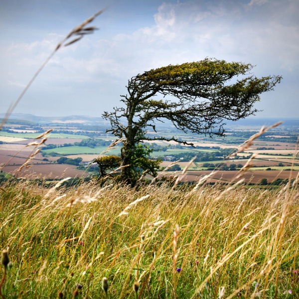
Weather: Wind
Windy hillside (oversnap, iStockphoto)
Windy hillside (oversnap, iStockphoto)
How does this align with my curriculum?
Learn what causes wind and how to measure it.
Wind is the movement of air across the surface of the Earth. Winds are named after the direction from which they blow. So, northeasterly winds blow from the northeast. And a land breeze blows from the land towards the ocean.
Air moves because the Sun does not warm the surface of Earth evenly. If Earth did not rotate, hot air at the Equator would rise up into the atmosphere. Then it would push cold air from the poles towards the equator. But the Earth’s spin causing something called the Coriolis Effect. This makes things travelling long distances around Earth appear to curve as they go. Even though the object travels in a straight line, we observe it from the moving surface of Earth. And different spots on Earth’s surface move at different speeds. Because Earth is a sphere, a town at the Equator spins faster than one near the North Pole, because it has further to travel in a day. A cannonball shot straight north from the Equator will actually land to the east! And winds travelling around the globe appear to blow in certain curved patterns. This is because air is flowing from a region that is moving faster to one that is moving slower.
A prevailing wind is a surface wind that blows mostly from a particular direction.
Have a look at the image below. In the area close to the equator, the winds blow mostly from the east. These winds are called the Prevailing Easterlies. North of the equator they blow from the northeast and are called the Northeasterly Trade Winds. South of the equator they blow from the southest and are called the Southeasterly Trade Winds.
Between 30° to 60°N and 30° to 60°S the winds blow mainly from the west. These are called the Prevailing Westerlies. Near the North and South Poles, the Coriolis force produces winds from the east, called Polar Easterlies.
What is global circulation? | Part Three | The Coriolis effect & winds (6:18) from Met Office - Learn About Weather

Image - Text Version
Shown is a colour illustration of Earth with latitudes and prevailing winds marked. Earth is shown as a circle with oceans in blue and land in green. Horizontal lines spaced out down the globe indicate certain latitudes. A little below the top, the first is yellow and labelled 60°N. The next one down is also yellow and labelled 30°N. The line in the middle is green and labelled 0°. Just above it is a red line labelled “Intertropical convergence zone.” Below, yellow lines indicate 30°S, and just above the bottom, 60°S. In between each latitude line is what looks like a flat, translucent blue pillow. Inside these are arrows in an oval shape which are red near Earth, and blue further away. These are labelled “Warm air rises and cool air sinks.” They point counterclockwise in the Northern Hemisphere and clockwise in the Southern Hemisphere. Between the top of the globe and 60°N, white arrows curve down and to the left. These are labelled “Polar Easterlies.” Between 60°N and 30°N, arrows curve up and to the right. These are labelled “Westerlies.” Between 30°N and the Intertropical convergence zone, arrows curve down and to the left. These are labelled “Northeasterly Trade Winds.” Between the Intertropical convergence zone and 30°S, arrows curve up and to the left. These are labelled “Southeasterly Trade Winds.” Between 30°S and 60°S, arrows curve down and to the right. These are labelled “Westerlies.” Between 60°S and the bottom of the globe, arrows curve up and to the left. These are labelled “Polar Easterlies.”
Wind patterns can also be seen on a smaller scale in different regions of the world. In western Canada you could experience a Chinook. Chinooks are winds that become warm and dry as they are pushed down the eastern side of the Rocky Mountains. Chinooks can change the temperature in southern Alberta from -20℃ to over 15℃ in a few hours! On the other side of Canada, some areas are always exposed to very high winds. This is the case for the Wreckhouse area in Newfoundland. And the “Les Suêtes” winds will blow you over in Nova Scotia.
Measuring Wind
Wind strength is the speed that wind blows. Most of us have experienced short bursts of high-speed wind. These are called gusts. Winds that blow non-stop for more than a minute are called squalls. Winds that last longer have different names, according to their average strength. These include breeze, gale, storm, hurricane and typhoon.
People have created a number of tools to measure the wind. A metal rooster with the symbols for north, south, east and west on the top of a building is a weather vane. It pivots in the wind to show what direction the wind is coming from.

Image - Text Version
Shown is a colour photograph of a metal rooster on a pole, with the letters N, E, W and S on metal arms below. The rooster is sculpted from a flat piece of metal painted orange, with rust spots. Under its feet is a strip of metal representing grass. Under this, a pointed rod extends out in front of the rooster. This is parallel to the arm with the letter E on the end, representing East. Light from the sunset makes the weathervane look as if it glows. The sky in the background goes from blue at the top to red at the bottom.
At airports, pilots use windsocks to determine wind direction. They can also use them to estimate the speed of the wind. Wind socks are conical tubes of thin material that move easily. The wind blows into the wide end of the tube and escapes out the narrow one. So, the narrow end always points in the opposite direction from where the wind is blowing. When the wind isn’t blowing, the sock hangs straight down. When the wind is strong, the sock is parallel to the ground.

Image - Text Version
Shown are five colour illustrations of a windsock moving with increasing wind speed. The windsock is a cone of orange and white striped fabric, suspended from a pole. In the first illustration, it is hanging straight down. This is labelled “No wind.” In the second, its wide top has angled slightly to the right, but its narrow end still hangs down. In the third, the whole sock is angled higher to the right. In the fourth, it is even higher, almost parallel to the ground. In the fifth, the whole sock is completely parallel to the ground. This is labelled “Strong wind.”
You can use an anemometer to measure the wind more precisely. Basic anemometers are made of cups mounted on arms connected to a rod. The faster the wind blows, the faster the cups rotate and spin the rod. Other anemometers look more like propellers with tails. The speed of the propeller indicates wind speed, and the tail shows wind direction.

Image - Text Version
Shown is a colour photograph of a small metal propeller attached to what looks like a small airplane tail. The propeller is small and dark grey. The tail is white and stretches out behind it, ending in a wide, flat vertical blade. The whole thing is mounted to a cylinder on top of a grey pole. Below and to the left, a bird sits on a round white chimney. The anemometer is a bit larger than the bird. The sky in the background is bright blue.
Did you know?
The word anemometer comes from the Greek word anemos meaning ‘wind’ and metron meaning ‘measure.’
The speed of wind can be described using the Beaufort Scale.
The Beaufort Scale
The Beaufort Scale was created by Sir Francis Beaufort in 1805. He did not use wind speeds for each level. Instead he used descriptions of how a sail on a ship moves in different winds. In the 1850s, wind conditions on land were added. Later, meteorologists added the number of turns of an anemometer to each level. The Beaufort Scale is still used to estimate wind strength today. But meteorologists usually describe wind speed in kilometres per hour or miles per hour.

Image - Text Version
Shown is a table of the Beaufort Scale with illustrations showing the effects on land and in water. The first column contains each Beaufort number, from 0-12. The second has small illustrations of a house on a beach, with a tree on one side and a flag pole on the other. The third has brief descriptions of the conditions at each level. The fourth column contains the wind speed for each. Below is the information in each column, followed by a description of its illustration.
0, Calm, 0-1 km/hr Here, the water is smooth, the tree is still, and the flag hangs down.
1, Light Air, 2-5 km/hr The water is smooth, the tree is still, and the flag hangs down.
2, Light Breeze, 6-11 km/hr The water is slightly rippled, the tree is still, and the flag has been lifted slightly.
3, Gentle Breeze, 12-19 km/hr The water is more rippled, a few leaves on the tree have blown away from the water, and the flag has been lifted to a near horizontal position.
4, Moderate Breeze, 20-28 km/hr The water is rippled, more leaves have blown away from the water, and the flag is horizontal.
5, Fresh Breeze, 29-38 km/hr The water has white caps on the surface, most of the leaves are blowing, and the flag is horizontal.
6, Strong Breeze, 38-49 km/hr The water has white caps, the surf is crashing on the beach, all the leaves are blowing, and the flag is stretched out in the wind.
7, Near Gale, 50-61 km/hr The water has waves, white caps, and more crashing surf. Leaves are starting to blow off the tree and a branch is bending. The flag is still stretched out.
8, Gale, 62-74 km/hr The water has waves, white caps and more crashing surf. More leaves are blowing off the tree, and roof tiles are blowing off the house. The flag is still stretched out.
9, Strong Gale, 75-88 The water is darker with larger waves, white caps and much more crashing surf. A branch has broken off the tree and many leaves and tiles are in the wind. A piece of fabric has been torn off the flag.
10, Storm, 89-102 km/hr The water is dark with even larger waves and surf getting closer to the house. The whole tree has bent over in the wind and branches are on the roof. There are several holes in the roof and half the flag has been torn away.
11, Violent Storm, 103-117 km/hr The water is filled with tall, white capped waves that are crashing near the walls of the house. The tree is bent over the roof. More tiles are gone, as is the whole flag.
12, Hurricane, 118+ km/hr Tall white waves are crashing into the house. Pieces of it are flying through the air. The tree and flag are gone.
In Canada, maritime winds forecast to be in the range of 6 to 7 on the Beaufort Scale are called strong. 8 to 9 are called gale force, 10 to 11 are called storm force, and 12+ is called hurricane force. Wind warnings are issued by Environment Canada.
Did you know?
Wind can be used to generate electricity. Wind turbines are structures placed in windy areas to harness the energy of wind.
Learn More
Measuring and Forecasting Weather
This backgrounder describes different weather instruments that meteorologists use to measure weather.
Tools: Weather Instruments
15 images of various instruments such as rain gauges, wind vanes and weather satellites used to inform us about the weather.
What is Wind? (2013)
This video by SciShow Kids (3:10 min.) explains where wind comes from, what factors influence it, and how fast it can go.
What is global circulation? | The Coriolis effect & winds (2018)
This video (6:18 min.) by the Met Office illustrates how the Coriolis Effect works on Earth’s surface, and in the atmosphere above.
Coriolis Effect (2012)
What happens when you throw a ball while spinning around on a merry-go-round? This video (2:57 min.) by National Geographic illustrates the Coriolis force.
References
Environment Canada. (2020). Criteria for public weather alerts: Wind.
EOceanic.com. (n. d.). Understanding the Beaufort Scale.
National Geographic. (2011). Coriolis Effect.
National Geographic. (2012). Wind,