Reaching the Arctic
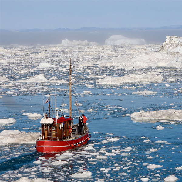
Ship in Arctic waters (Sarah N, Pixabay)
Ship in Arctic waters (Sarah N, Pixabay)
How does this align with my curriculum?
How will arctic ice melt from climate change affect exploration, scientific research and geopolitics?
Have you ever wondered how ships sail through the Arctic? I mean, it’s covered by ice year-round...isn’t it?
I had no idea how this was possible - until recently. I met a young fellow who had the opportunity to sail near the geographic North Pole on a type of ship called an icebreaker. The young man showed me Global Positioning System (GPS) data showing a latitude of near 89.9° N! That’s pretty close to the North Pole, which is at latitude 90° N.

The North Pole isn’t easy to reach in the winter, when the ice is widespread and at its thickest. This young man managed to get up there in August 2016 because of ice melt. Ice melt occurs naturally in the summer, but has increased in recent years because of climate change. With ice melt comes a variety of negative consequences that can have disastrous impacts. But ice melt can also lead to new opportunities for scientific research. This creates a need for discussions and decisions about natural resources and territorial boundaries.
Is Arctic ice melting?
There has been ice year-round in the Arctic for a very long time, but there is less of it year after year. According to NASA, the Arctic sea ice in September is currently declining at a rate of 12.8% per decade. That’s based on the average measured between 1980 and 2010. Though it is declining, levels go up and down every year. The lowest sea ice recorded so far by NASA’s satellites was in September 2012.
Did you know?
If the current trend continues, the Arctic might become ice-free during summers in the next few decades.
Today’s melting arctic ice trend will change sea levels, ocean conditions, and the Earth's temperature. All of these changes will have potentially serious consequences for all life forms on the planet, including you and me.
However, less ice could lead to more scientific discoveries in the Arctic. It’s always been difficult for scientists to access the Arctic, which means they still don’t fully understand it. When humans first tried to explore this region by ship, they had pretty serious difficulties. That’s because the ice was so thick and widespread that the strongest icebreakers couldn’t get through it. Now, the melting of thick Arctic ice allows hard-core icebreakers to reach higher latitudes. There, scientists can collect new water, air and sediment samples. This can help scientists understand both the history and the future of the Arctic.

What is the continental shelf?
Less ice also means greater access to the natural resources found in the Arctic. This raises some geopolitical issues. An important part of this discussion is the continental shelf. Generally speaking, the continental shelf is the part of the continent that lies just beneath the ocean. It is usually shallow (between 100 and 200 metres deep) and ends in a steep slope that reaches the ocean floor.
It’s important for governments to know where the Canadian continental shelf stops so that they can claim territories and secure natural resources like oil and gas in the Arctic. That’s because some natural resources are found in the continent below the water. Under United Nations rules, a country can claim the land within what’s called the exclusive economic zone. That’s 200 nautical miles from its shoreline. However, a country may also claim territory beyond that 200 nautical miles if it can prove that the land is a natural extension of its continental shelf. That could mean that new and more natural resources may be claimed as Canadian properties.
Did you know?
Canada includes 7.1 million square kilometres of ocean.
To map the continental shelf, people use ice-strengthened vessels equipped with devices such as echo sounders. These are instruments that emit sound waves and use high and low frequencies to determine water depths and other natural features over the seafloor such as ridges and volcanoes. Canadian ships equipped with these echo sounders, such as the Louis S. St-Laurent of the 2016 Canada-Sweden Polar expedition, have already started to survey the Arctic waters to study and map Canada’s continental shelf.
I’m a geologist by training, so I found this application particularly interesting. It’s a good example of how sciences be linked to other aspects of life, like politics.
Students on ice program
The Arctic isn’t just for experienced scientists anymore. For example, the Students on Ice program has given many young adults the chance to make their dreams of visiting the Arctic come true! Programs like these give teens a chance to learn about the Arctic and the type of research being done there. Science allows explorers of all ages to discover the unknown!
Did you know?
Researchers have found evidence that the Arctic may have had ice-free summers, with temperatures between 4 and 7° C around six to ten million years ago.
Starting Points
- Have you ever been to the Arctic? Is it a place that you would like to visit?
- What do you think of when you hear about arctic ice melting? Why?
- Would you consider signing up for a student learning program that takes place in the Arctic? Why or why not?
- Why is learning more about the geography of the Arctic important to the Canadian government?
- Should the search for natural resources in the Arctic outweigh the dangers of travelling in arctic waters?
- What technology is making it possible to study the continental shelf in the Arctic?
- What is an exclusive economic zone? What benefit(s) does it provide to a country?
- What is the continental shelf? How did it form?
- How is climate change impacting the sea ice in the Arctic?
- Why is there interest in exposing young people to the arctic environment and current arctic research efforts? What is the value for science now and in the future?
- What have you seen in the news recently about arctic research? What types of research were being featured in the media?
- This article and embedded video support Earth & Environment studies related to climate change, sea ice and oceans. Concepts introduced include icebreaker, GPS, latitude, the North Pole, ice melt, natural resources and the continental shelf.
- After reading the article, teachers could have students complete a Pros & Cons Organizer learning strategy to think of the positive and negative impacts of melting ice in the Arctic (e.g., melting ice can increase access for researchers, miners and tourists; melting ice could cause flooding in coastline communities; increased traffic and resource development in Arctic waters could negatively affect the ecosystem). Ready-to-use Pros & Cons reproducibles are available in [Google doc] and [PDF] formats.
- Students could also conduct an Issues & Stakeholders learning strategy to think critically about the impacts of increased access to the continental shelf due to ice melt from the position of different stakeholders. Ready-to-use Issues & Stakeholders reproducibles are available in [Google doc] and [PDF] formats.
- For a technology focus, teachers could have students research and explain how an icebreaker ship works. Students could consider what makes icebreakers different from other types of ships. Students could also look at where else in Canada icebreaking ships are used (e.g., in the Great Lakes and the Saint Lawrence River).
Connecting and Relating
- Have you ever been to the Arctic? Is it a place that you would like to visit?
- What do you think of when you hear about arctic ice melting? Why?
- Would you consider signing up for a student learning program that takes place in the Arctic? Why or why not?
Relating Science and Technology to Society and the Environment
- Why is learning more about the geography of the Arctic important to the Canadian government?
- Should the search for natural resources in the Arctic outweigh the dangers of travelling in arctic waters?
- What technology is making it possible to study the continental shelf in the Arctic?
- What is an exclusive economic zone? What benefit(s) does it provide to a country?
Exploring Concepts
- What is the continental shelf? How did it form?
- How is climate change impacting the sea ice in the Arctic?
Nature of Science/Nature of Technology
- Why is there interest in exposing young people to the arctic environment and current arctic research efforts? What is the value for science now and in the future?
Media Literacy
- What have you seen in the news recently about arctic research? What types of research were being featured in the media?
Teaching Suggestions
- This article and embedded video support Earth & Environment studies related to climate change, sea ice and oceans. Concepts introduced include icebreaker, GPS, latitude, the North Pole, ice melt, natural resources and the continental shelf.
- After reading the article, teachers could have students complete a Pros & Cons Organizer learning strategy to think of the positive and negative impacts of melting ice in the Arctic (e.g., melting ice can increase access for researchers, miners and tourists; melting ice could cause flooding in coastline communities; increased traffic and resource development in Arctic waters could negatively affect the ecosystem). Ready-to-use Pros & Cons reproducibles are available in [Google doc] and [PDF] formats.
- Students could also conduct an Issues & Stakeholders learning strategy to think critically about the impacts of increased access to the continental shelf due to ice melt from the position of different stakeholders. Ready-to-use Issues & Stakeholders reproducibles are available in [Google doc] and [PDF] formats.
- For a technology focus, teachers could have students research and explain how an icebreaker ship works. Students could consider what makes icebreakers different from other types of ships. Students could also look at where else in Canada icebreaking ships are used (e.g., in the Great Lakes and the Saint Lawrence River).
Learn more
Definitions of Canada’s Maritime Zones
Fisheries and Oceans Canada - How the six different international borderlines around Canada’s oceans are defined
Arctic Sea Ice News and Analysis
This article from the (US) National Snow & Ice Data Center tracks the amount of ice each season and has plenty of background information on how it’s measured and why it’s important
Arctic Report: Inside An Icebreaker Ship (2016)
A colourful and plentifully illustrated account from Popular Science of what it’s like on board a Norwegian icebreaker
Research ship mapping Arctic Ocean near North Pole (2016)
An account on CBC News of the Canada-Sweden Polar expedition with interesting pictures and news of their discoveries.
The End of the Arctic (2016)
This video (13:38 min.) from ASAP Science explains the consequences of arctic ice melt. Narrated by a Canadian duo sailing to Baffin Island and speaking to the Inuit communities to live there.
References
Stein, R., Fahl, K., Schreck, M., Knorr, G., Niessen, F., & Forwick, M. et al. (2016). Evidence for ice-free summers in the late Miocene central Arctic Ocean. Nature Communications, 7(1). DOI: 10.1038/ncomms11148