Alexis Dorais
Remote Sensing Analyst
Enfotec Technical Services Inc.
Learn About My Career
Alexis Dorais is a Remote Sensing Analyst for Enfotec Technical Services Inc.
I was born/grew up in: I was born and raised in Montréal, Québec, Canada, where I spent most of my life.
I now live in: Montréal, Québec, Canada
I completed my training/education at: I have a Bachelor’s degree in physical geography and a Master’s degree in geography, both from the Université de Montréal.
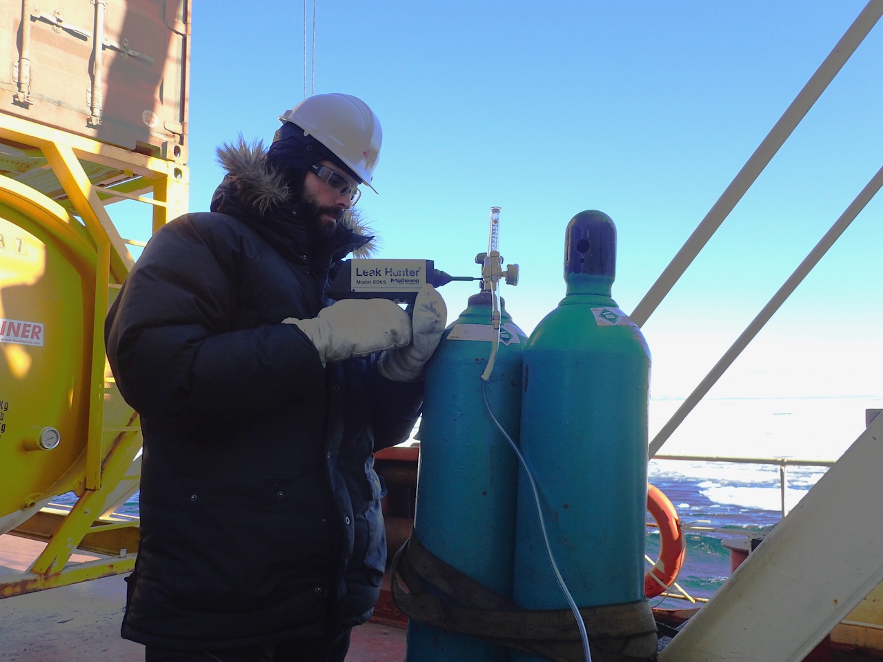
Every day I keep track of ships that I support as they navigate in ice-infested waters. I make sure they have access to the most up to date and relevant information to help these vessels operate safely and efficiently. This information can consist of satellite images as well a variety of weather and ice charts. I participate in the development and sale of an ice navigation system. This navigation system enables the crew to visualise and use satellite images and charts. It also provides them with a specialised ice radar. I take care of the installation and maintenance of this equipment onboard these ships. I also provide training to ship crews on how to use this equipment.
I also prepare ice assessments based on satellite images as well as the current weather and climate data. These help support ongoing marine operations at high latitudes. It is also used for planning future shipping projects such as developing a mine in a remote area in northern Canada. When planning is being done for future shipping projects, the work I do is used to incorporate the needs of shipping companies in areas where ice is present within commercial models. These commercial models are then used to create logistic chains for a project as a whole. I’m also involved in research and development projects that relate to ice navigation. This might be evaluating the use of drones to support ship navigation in ice conditions or testing new satellite communications systems onboard vessels.
I decided to study geography because I knew there were going to be great challenges ahead for the human population. I was very interested in how our expanding world population would cope on a planet that was getting even more stressed by how we were using its resources. During my bachelor’s degree, I discovered geomatics and remote sensing and became skilled in both disciplines. I decided to deepen my knowledge of remote sensing and geomatics by taking a second cycle certificate focussing on these subjects. As I was finishing the certificate, I was recruited to participate on a study of how the country of Borneo was moving away from being a mainly farming society. I converted the certificate into credits for a Masters degree that I did while working on that project on Borneo. The remote sensing background I developed at University allowed me to apply for a remote sensing analyst job at Fednav, where I am today.
Many things motivate me in my work. I get to meet and work with lots of interesting people. A lot of my work involves problem solving, which I find quite stimulation. I have a lot of autonomy in how I do my job. The work I do is varied. I spend most of the time in an office, but I also spend some time on ships working with my hands as well as my mind. I have an opportunity to sail on ships that travel at high latitudes in an Arctic environment. These journeys are especially exciting as there is no other way to get to those destinations in winter than on heavy-duty icebreaking ships. I work with state of the art tools and technology. I also get to travel to many interesting and unusual destinations, both up north and around the world.
What I do is a service, so I’m directly helping people who rely on my expertise to make decisions. The work I do helps complex operations involving hundreds of people and millions of dollars worth of cargo unfold more smoothly.
I like to spend time with my kids. I enjoy the outdoors. I play hockey regularly. I like to bike in the summer time and ski in the wintertime. I like to fix things and do work around the house. I enjoy arts and music.
Being skilled with the software tools for remote sensing and geomatics is good. Understanding the data and how to use it when there are no tools readily available is better. Programming knowledge is a valuable asset.
What I do at work
Every day I keep track of ships that I support as they navigate in ice-infested waters. I make sure they have access to the most up to date and relevant information to help these vessels operate safely and efficiently. This information can consist of satellite images as well a variety of weather and ice charts. I participate in the development and sale of an ice navigation system. This navigation system enables the crew to visualise and use satellite images and charts. It also provides them with a specialised ice radar. I take care of the installation and maintenance of this equipment onboard these ships. I also provide training to ship crews on how to use this equipment.
I also prepare ice assessments based on satellite images as well as the current weather and climate data. These help support ongoing marine operations at high latitudes. It is also used for planning future shipping projects such as developing a mine in a remote area in northern Canada. When planning is being done for future shipping projects, the work I do is used to incorporate the needs of shipping companies in areas where ice is present within commercial models. These commercial models are then used to create logistic chains for a project as a whole. I’m also involved in research and development projects that relate to ice navigation. This might be evaluating the use of drones to support ship navigation in ice conditions or testing new satellite communications systems onboard vessels.
My career path is
I decided to study geography because I knew there were going to be great challenges ahead for the human population. I was very interested in how our expanding world population would cope on a planet that was getting even more stressed by how we were using its resources. During my bachelor’s degree, I discovered geomatics and remote sensing and became skilled in both disciplines. I decided to deepen my knowledge of remote sensing and geomatics by taking a second cycle certificate focussing on these subjects. As I was finishing the certificate, I was recruited to participate on a study of how the country of Borneo was moving away from being a mainly farming society. I converted the certificate into credits for a Masters degree that I did while working on that project on Borneo. The remote sensing background I developed at University allowed me to apply for a remote sensing analyst job at Fednav, where I am today.
I am motivated by
Many things motivate me in my work. I get to meet and work with lots of interesting people. A lot of my work involves problem solving, which I find quite stimulation. I have a lot of autonomy in how I do my job. The work I do is varied. I spend most of the time in an office, but I also spend some time on ships working with my hands as well as my mind. I have an opportunity to sail on ships that travel at high latitudes in an Arctic environment. These journeys are especially exciting as there is no other way to get to those destinations in winter than on heavy-duty icebreaking ships. I work with state of the art tools and technology. I also get to travel to many interesting and unusual destinations, both up north and around the world.
How I affect peoples’ lives
What I do is a service, so I’m directly helping people who rely on my expertise to make decisions. The work I do helps complex operations involving hundreds of people and millions of dollars worth of cargo unfold more smoothly.
Outside of work I
I like to spend time with my kids. I enjoy the outdoors. I play hockey regularly. I like to bike in the summer time and ski in the wintertime. I like to fix things and do work around the house. I enjoy arts and music.
My advice to others
Being skilled with the software tools for remote sensing and geomatics is good. Understanding the data and how to use it when there are no tools readily available is better. Programming knowledge is a valuable asset.
When I was a student I enjoyed:
- Computer Science
- Music
- Art
- Drama
- Geography
- Foods & Nutrition
- Science
- Technology
When I was a student, I would describe myself as someone who:
- Always wanted to be outside
- Enjoyed working with my hands
- Liked being given free range to explore my ideas
- Liked reading
- Didn't really care about grades
- Wasn't sure what I wanted to do
- Liked to take things apart to see how they worked
- Liked to design or build things
Related Topics
Explore More Career Profiles
-
Brianna Lummerding
Career Profiles
Agronomic Innovation Manager
I look after all things related to soil management for a group of retailers. -
Li Tan (he/him)
Career Profiles
Molecular Lead
I coordinate the day-to-day operations in the DNA Extraction Lab. -
Tyler Morhart (video)
Career Profiles
Scientist, Beamline Responsible - SyLMAND
I am responsible for the SyLMAND beamline at the Canadian Light Source synchrotron facility. -
Li Tan (Video)
Career Profiles
Molecular Lead
I coordinate the day-to-day operations in the DNA Extraction Lab. -
Rashell Featherstone (she/her)
Career Profiles
Senior Program Associate
I coordinate projects for the development of new products at STEMCELL. -
Kira Hoffman (she/her)
Career Profiles
Postdoctoral Researcher/Fire Ecologist
I am a researcher at both a university and a not-for profit organization where I am gaining experience to become a senior researcher. -
Zoë Ehlert (Video)
Career Profiles
Manager, Marker Assisted Breeding
I lead a team that develops canola crops by breeding plants with traits we are looking for. -
Zoë Ehlert
Career Profiles
Manager, Marker Assisted Breeding
I lead a team that develops canola crops by breeding plants with traits we are looking for. -
Jennifer Baltzer (she/her)
Career Profiles
Professor and Canada Research Chair in Forests and Global Change
I work at a university, teaching students and conducting research on the impact of climate change on forests in Canada and around the world. -
Caitlyn Lyons (she/her)
Career Profiles
Ph.D. Candidate
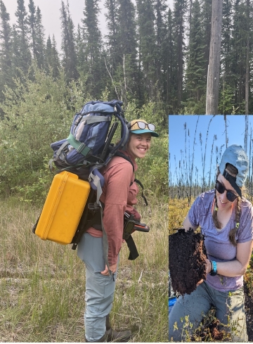
I am working towards my PhD and studying the forests in the Northwest Territories. -
Joann Whalen
Career Profiles
Professor at the Faculty of Agricultural and Environmental Sciences,
I teach advanced courses on how to manage soils to produce healthy, nutritious food and maintain healthy ecosystem functions.
