Climate Math
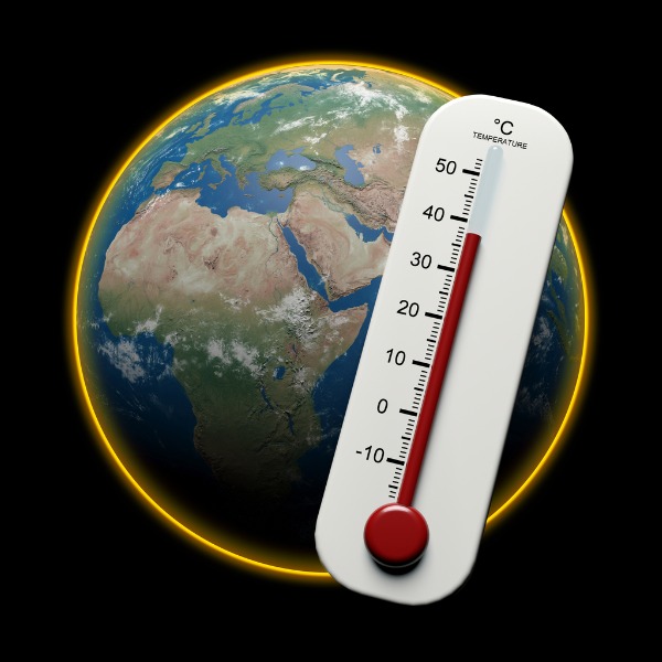
Earth with thermometer (Thibault Renar, iStockphoto)
Earth with thermometer (Thibault Renar, iStockphoto)
How does this align with my curriculum?
Learn about how to calculate temperature anomalies as a way of understanding how our climate is changing.
How do we know Earth is getting warmer?

Image - Text Version
Shown are various kinds of thermometers. At the top is a digital thermometer that reads 14°C. In the middle is a mercury and glass thermometer. The red liquid in this thermometer is almost reaching the top of the glass, indicating a warm temperature. At the bottom is a dial showing a temperature of 60°F.
For one, scientists get temperature data from thousands of weather stations around the world. Some of these stations record the temperature every couple of minutes. Think about how many numbers that is!

Image - Text Version
Shown is a map of the world with dots indicating 6,300 weather stations that collect data. Weather stations are shown all over the world, including in Antarctica and in the oceans. Weather stations are more highly concentrated in a few locations including North America, Europe, Eastern Asia, Western Arica, and Eastern South America.
In Canada, observations of temperature are stored in the National Climate Data and Information Archive. These observations come from organizations, such as Aviation Weather Services and the Department of National Defense. The map below shows locations where data has been collected in the past and where it is collected today. There are 508 locations with an active station and records from before 1990 (blue dots). There are 53 locations with an active station and records starting from 1990 (green dots). There are 219 locations with closed stations but with more than 30 years of data (red dots).

Image - Text Version
Shown is a map of Canada with dots indicating the location of temperature collection stations. Stations are spread across the whole country. A higher density of collection stations is indicated in the southern portion of Canada and around urban centers.
Imagine if scientists put all that temperature data into a massive list. Do you think that they would be able to easily understand how the climate is changing? Probably not! Scientists need to organize the data so that they can look for and .
Seasonal Variation
One way to help us see trends is by creating . However, even when we graph temperature data, it can still be hard to see long-term trends. This is because in many locations temperature varies a lot over the year.
For example, look at the line graph below for Toronto, Ontario. What are the lines showing?

Image - Text Version
Shown is a graph of average minimum and maximum monthly temperatures for Toronto, Ontario. There are two lines. The top red line indicates the average maximum temperature. The bottom blue line indicates the average minimum temperature. Both lines form a mountain shape with low points in December and January and a peak in July and August. The top line generally indicates a temperature between 5 and 9 degrees warmer than the bottom line.
The top red line is the average maximum temperature for each month. The bottom blue line is the average minimum temperature for each month.
Q1: What patterns or trends do you think you see?

Image - Text Version
Shown is an illustration of the same tree through the four seasons. The illustration for each season appears as a card resembling a Polaroid photo. The tree in winter does not have any leaves. It's base is surrounded by snow. The tree in spring has buds just beginning to form on the branches and the snow around the base is almost completely gone. The tree in summer is covered in green leaves and the base is surrounded by green grass. The tree in autumn has orange leaves which are beginning to fall off. Surrounding the tree is brown grass and fallen leaves.
Here is another graph. It shows average temperatures in Toronto for every year between 1840 and 2015. Look at the lines of this graph. What does each line represent?

Image - Text Version
Shown is a graph of average July and January temperatures in Toronto between 1840 and 2015. Two lines are shown. The top red line is the average temperature for July. The bottom blue line is the average temperature for January. Both lines have many peaks and valleys. There is greater temperature variation in January, where the average temperature ranges from -6.9°C to 4.4°C. The July average temperature ranges from 22.6°C to 31.2°C.
The top red line is the average temperature for July. The bottom blue line is the average temperature for January. Now what patterns or trends do you see?
Q2: What does this graph tell us about the climate in Toronto? What does this graph NOT tell us about the climate in Toronto?
It is pretty hard to see patterns and trends with a graph like this. Luckily, scientists have thought of a way to look at the data differently.
Temperature Anomaly

Image - Text Version
Shown is an illustration beside the definition of a temperature anomaly. A vertical doubled-headed arrow is between the phrases "Today's Temperature" and "Baseline Temperature".
A temperature anomaly can tell us how this December is different from past Decembers. It can also show us how the temperature at a place has changed over time. It is pretty easy to calculate a temperature anomaly. All you need is simple subtraction. Let’s give it a try.
Example 1: Winnipeg
Take a look at this temperature data from Winnipeg. Let’s calculate the temperature anomaly for July 2021.
| July 2021 Average Temperature | Baseline Period July Average Temperature (1961-1990) |
| 22.7°C | 19.8°C |
Average Temperature - Baseline Temperature = Temperature Anomaly
22.7 °C - 19.8°C = 2.9°C
This means that the temperature anomaly for July 2021 in Winnipeg is 2.9°C. July 2021 was 2.9°C warmer than an average July.
Now you give it a try:
Q3: Calculate the temperature anomaly for Montreal in October 2021. Use the data table below.
| October 2021 Average Temperature | Baseline Period October Average Temperature (1961-1990) |
| 11.9°C | 9.7°C |
Both of those temperature anomalies were positive. Positive temperature anomalies mean that an observed temperature was warmer than average. Negative temperature anomalies mean that an observed temperature is colder than average.
Q4: Calculate the temperature anomaly for Vancouver in February 2019. Use the data table below.
| October 2021 Average Temperature | Baseline Period October Average Temperature (1961-1990) |
| 3.5°C | 4.7°C |
Visualizing Temperature Anomalies
Just like we can graph actual temperatures and average temperatures, we can also graph temperature anomalies.
The below shows yearly temperature anomalies in Ontario from 1900 to 2018. The temperature anomaly for each year is represented by a green dot.
")
Image - Text Version
Shown is a scatterplot of yearly Ontario average temperature anomalies from 1900 to 2018. Anomalies range from about -1.75°C to 3°C. Most anomalies are between -1°C and 2°C. There is a cluster of greater temperature anomalies between 1980 and 2018 that range from 2 to 3°C.
Visualizing temperature anomalies is much more helpful than looking at absolute temperatures. It is much easier to see trends when we look at temperature anomalies. Can you see a trend here? Probably not.
To look for a trend, you can draw a trend line. A trend line, also known as a line of best fit, shows the relationship between two . In this case, the relationship between temperature and year. A line of best fit is a straight line drawn on a scatter plot that best represents the trend of the data. The line of best fit is as close as possible to all of the points on a scatter plot. This usually means that approximately half of the points are above the line and half are below the line. If the line slopes up to the right, the is positive. If the line slopes down the right, the slope is negative.
Q5: Hold a ruler up to the scatterplot above. Try to get half of the points to be above and half below. Where do you think the line of best fit would be?
Finding a line of best fit by eye alone can be tricky. This is why a statistical tool called regression analysis is used to calculate an accurate line of best fit.
The red line is the line of best fit for the data in the scatterplot. How close was your line?
")
Image - Text Version
Shown is the same scatterplot of yearly Ontario average temperature anomalies as above with the addition of a line of best fit superimposed on the data points. The trend line starts around 0°C in 1900 and gradually slopes up to about 1.3°C in 2018.
Q6: Based on the line of best fit, what can we say about the temperature trend in Ontario? Do you expect temperatures to be warmer or cooler in the future?
We can take a similar look at global temperature anomalies. The graph below shows the change in global surface temperatures relative to 1951 -1980 average temperatures. Instead of a straight line of best fit, it takes all of the points and creates a curved line of best fit.

Image - Text Version
Shown is a graph of global temperature anomaly from 1880-2020. A wavy line shows changes in temperature anomaly. Anomalies range from around -0.5°C to 1°C. From 1980 to 2020 the line slopes upwards.
It is clear that temperature anomalies continue to increase. This means that temperatures are becoming warmer than past average temperatures. Even small increases in global temperatures can have a big impact on our planet.
Did you know?
Nineteen of the warmest years since 1880 have happened since 2000.
Temperature anomalies address other issues that scientists run into when analyzing temperature data. For example, weather stations are sometimes moved or data is missing from the record. These changes can impact average temperature data. However, temperature anomalies are much less affected by these types of problems.
Other ways of visualizing data provide new ways of thinking about temperature trends. For example, maps can help us look at temperature trends in many locations at once.
The map below shows how local temperatures in 2020 have increased relative to 1951-1980 average temperatures.

Image - Text Version
Shown is a map of the world indicating how local temperatures in 2021 have increased relative to 1951-1980 average temperatures. Color is used to indicate temperature anomaly. Shades of blue indicate a negative anomaly, and shades of red indicate a positive anomaly. Darker shades indicate an anomaly that is further away from zero. Most of the world is yellow or orange, indicating an increase of 0.5 to 2°C. A patch of dark red around Northern Europe and the Arctic indicates temperature anomalies between 4 and 7°C. Very little of the world is blue, indicating a negative temperature anomaly. Only a few small patches of the ocean are a very light blue, indicating a temperature anomaly of about -0.5°C.
Q7: What do you notice when you look at the map? In what parts of the world were 2020 temperatures the most different from average?

Image - Text Version
Shown is a visual representation of temperature anomalies from 1850-2020 called Warming Stripes. The image is made up of vertical stripes of blue and red. Each stripe indicates the temperature anomaly for one year. Blue stripes indicate negative temperature anomalies. Red stripes indicate positive temperature anomalies. Darker shades indicate an anomaly that is further away from zero. The earlier stripes on the left side of the image are primarily dark blue. As you move further right, the stripes become lighter blues and then lighter reds. The most recent stripes are primarily dark reds, indicating increasing temperatures.
Similarly, the Prairie Climate Centre created a warming stripes image for Canada.

Image - Text Version
Shown is a visual representation of temperature anomalies in Canada from 1898-2016. Similarly to the above image, this graphic is made up of vertical stripes of blue and red. Each stripe indicates the temperature anomaly for one year. Blue stripes indicate negative temperature anomalies. Red stripes indicate positive temperature anomalies. Darker shades indicate an anomaly that is further away from zero. This graphic represents temperature anomalies in each season as well as the annual anomaly.The earlier stripes on the left side of the image are primarily blue. As you move further right, an increasing proportion of the stripes become red. The most recent stripes are primarily dark reds, indicating increasing temperatures. Winter has the most extreme changes, with more dark red stripes in recent years than other spring, summer, or fall.
Temperature trends and other indicators show us that the climate is warming. This warming is already having large impacts on the world as we know it. We humans will need to make choices that keep temperatures from continuing to go up. You can make a big difference by taking action now. Sharing thought-provoking data visualizations is one way that we can address climate change. We need people like you who can use data to explain how we know the climate is changing. Understanding these trends helps us tackle this problem together.
ANSWERS
Q1: What patterns or trends do you think you see?
Temperatures are warmer in the summer months and cooler in the winter months. July is the month with the warmest average temperature and January is the month with the coldest average temperature.
Q2: What does this graph tell us about the climate in Toronto? What does this graph NOT tell us about the climate in Toronto?
The graph shows that the average July temperatures vary from a low of 22.6℃ to a high of 31.2℃. The lowest average July temperature was in the early 1990s and the highest was in the early 1920s. The graph shows that the average January temperatures vary from a low of -6.9℃ to a high of 4.4℃. The lowest average January temperature was in the late 1850s and the highest was in the early 1930s.
The graph does not tell us about the climate in the spring or fall.
Q3: Calculate the temperature anomaly for Montreal in October 2021
11.9 °C - 9.7°C = 2.2°C: This means that October 2021 was 2.2 °C warmer than average.
Q4: Calculate the temperature anomaly for Vancouver in February 2019. Use the data table below.
3.5°C - 4.7°C = -1.2 °C. This means that February 2018 was 1.2 °C cooler than average.
Q5: Hold a ruler up to the scatterplot above. Try to get half of the points to be above and half below. Where do you think the line of best fit would be?
Answers will vary.
Q6: Based on the line of best fit, what can we say about the temperature trend in Ontario? Do you expect temperatures to be warmer or cooler in the future?
The temperature trend is upward. Based on this, we would expect warmer than average temperatures in the future.
Q7: What do you notice when you look at the map? In what parts of the world were 2020 temperatures the most different from average?
You probably noticed that almost every location had a positive temperature anomaly. This means temperatures in 2020 were warmer than average almost everywhere in the world. Also, global temperature is increasing more in some places than others. Parts of northern Europe and northern Russia have the largest temperature anomalies.
Learn More
Graphing Global Temperature Trends
Practice graphing global temperature trends with this classroom activity from NASA’s Jet Propulsion Laboratory.
How to Measure Global Average Temperature in Five Easy Steps
This cartoon from UCAR Center for Science Education summarizes how to measure global temperature using temperature anomalies.
Climate Atlas of Canada
The Climate Atlas of Canada combines climate science, mapping and storytelling to bring the global issue of climate change closer to home for Canadians.
Indicators of Climate Change
This backgrounder from Let’s Talk Science explores how we know the climate is changing.
What is the Greenhouse Effect?
This backgrounder from Let’s Talk Science explains why temperatures are rising.
Clothing4Climate Actions
Check out the Clothing4Climate Project from Let’s Talk Science for ideas around how to take action.
References
Banas, T (Jun 25, 2018). How to Calculate Trendline. Classroom. Retrieved from https://classroom.synonym.com/calculate-trendline-2709.html
Environment and Climate Change Canada (Nov 25, 2021). Canadian Climate Normals 1961-1990 Station Data. Retrieved from https://climate.weather.gc.ca/climate_normals/results_1961_1990_e.html?searchType=stnProv&lstProvince=MB&txtCentralLatMin=0&txtCentralLatSec=0&txtCentralLongMin=0&txtCentralLongSec=0&stnID=653&dispBack=0
Lucie A. Vincent, Megan M. Hartwell & Xiaolan L. Wang (2020) A Third Generation of Homogenized Temperature for Trend Analysis and Monitoring Changes in Canada’s Climate, Atmosphere-Ocean, 58:3, 173-191, DOI: 10.1080/07055900.2020.1765728
Mathcation.com (Oct 7, 2018). Line of Best Fit [Video]. YouTube. https://www.youtube.com/watch?v=zLxRcUX_oMQ
National Centers for Environmental Information (n.d.) Anomalies vs. Temperatures. National Oceanic and Atmospheric Administration. Retrieved from https://www.ncdc.noaa.gov/monitoring-references/dyk/anomalies-vs-temperature
National Centers for Environmental Information (n.d.) Global Surface Temperature Anomalies. National Oceanic and Atmospheric Administration. Retrieved from https://www.ncdc.noaa.gov/monitoring-references/faq/anomalies.php
Open Mind (Jul 29, 2018). Why use temperature anomaly? Retrieved from https://tamino.wordpress.com/2018/07/29/why-use-temperature-anomaly/
Pidcock, R. (Jan 16, 2015). Explainer: How do scientists measure global temperature? Carbon Brief. Retrieved from https://www.carbonbrief.org/explainer-how-do-scientists-measure-global-temperature
Weatherstats.ca (n.d.) Canada Weather Stats. Retrieved from https://www.weatherstats.ca/