Peat Bogs and the Ring of Fire
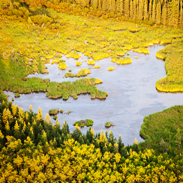
Peat bog in northern Alberta (Ashley Cooper, Getty Images)
Peat bog in northern Alberta (Ashley Cooper, Getty Images)
How does this align with my curriculum?
Learn about peat bogs, the threats they face and how you can help.
Think of an ecosystem you know. Did you think of peat bogs? Probably not! This ecosystem may not be the first one you think of, but it is incredibly important for many reasons. It is also at risk. Peat bogs are rapidly changing due to climate change and human activities. This change is already impacting the plants, animals and people who depend on peat bogs. By learning about this ecosystem, we can all help protect it.

Image - Text Version
Shown is a colour photograph of a flat, green area next to water. The camera is focused on the ground in the foreground. It is densely packed with green, low plants. The curved edge of a body of water is visible on the left side. The shore beyond is lined with grey tree trunks without leaves or needles. In the distance is a low, densely forested hill.
What are peat bogs?
Peat bogs are a type of freshwater wetland. They form in places where water pools and does not drain. This includes old river valleys, coastal areas and the depressions in land caused by the retreat of glaciers.
Peat bogs form when plants grow, then die around the body of water. As the plants die, decaying plant matter accumulates over thousands of years. This increase in organic plant matter over time is called paludification. New plants move in to grow on the organic matter. These slowly fill in the lake.This process is called terrestrialization.

Steps in the formation of a peat bog (©2023 Let’s Talk Science).
Image - Text Version
Shown is a colour animated GIF with numbered images of the steps. Step one shows a side view of a layer of brown soil with a dip in the middle. This is filled in and covered by a layer of white, labelled “Glacier.” Step two shows that the glacier has turned into a body of blue water, surrounded by a few trees. Step three shows green, bushy shapes labelled “Sphagnum moss” growing along the edges of the water, near a few grey, broken tree trunks. Step four shows the edges of the water have been filled in with a brown substance labelled “Peat.” These areas are covered in a layer of green with a few live trees and a few dead trunks along the edges of the original dip. This makes the body of water significantly smaller. In the sky above, two long arrows point in toward the middle of the image. These are labelled “Terrestrialization.” Two more arrows point out toward the edges of the image. These are labelled “Paludification.” Step five shows the original dip is almost completely filled in with peat. This is covered with a thick layer of green. This is scattered with a few shrubs, live evergreen trees, and dead tree trunks near the edges of the peat. In the sky above, the two arrows labelled “Terrestrialization” have met in the middle of the image. The two arrows labelled “Paludification” have reached the left and right edges of the peat below.
Peat bogs are different from other wetlands because they are very acidic. This is caused by two factors. One is the breakdown of the organic matter, which produces organic acids. The second is poor drainage. This prevents less acidic water from moving through the bog and raising its pH.
Bogs are found all over the world. Generally they are found in cooler, northern areas. In Canada, there are major bogs in different regions across the country. In Northern Ontario, there is an extensive network of peat bogs in the Hudson Bay lowlands. In Quebec, there is a system of peat bogs in the St. Lawrence Valley. Bogs are also common in Alberta’s boreal region. These are just a few of the many bogs across Canada.
Did you know?
Bog snorkelling is a competitive sport! Snorkelers must swim back to back 55 metre lengths in a water-filled trench that has been cut through a peat bog. They must do this using only the power of their flippers! Whoever completes the lengths the fastest wins the title of bog snorkeller champion!
Bogs are full of life! The most widespread plant in bogs is Sphagnum. This is a type of moss. There are over 380 known species of sphagnum.
People often call sphagnum moss peat moss. But these two names do not mean the same thing. Living sphagnum moss grows on the surface of the bog. Below this layer is dead and decaying sphagnum moss. This layer is called peat moss. If you walk on peat moss it feels squishy and wet.

Image - Text Version
Shown is a colour photograph of green, feathery-textured plants. The plants are shown from above. They are densely packed, with no ground visible in between. The top of each structure has star-shaped clumps of leaves that look like bunches of thick, long, drooping hair or feathers.
Peat is different from peat moss and sphagnum. Peat is a brown soil-like material. It is made of partly decayed moss and other plants. Plants decay slowly in peat bogs because they are always under water and never exposed to air. Scientists call this type of environment anaerobic.

Image - Text Version
Shown is a colour photograph of a wedge-shaped piece of soil that has been dug from the ground. The soil looks like it has been sliced from the land around it. The soil is a pale, greyish brown colour on the bottom, and a richer brown colour near the top. It is topped by pale gold plants that look like dry grass. Around the piece of soil are a few green plants as well as some additional greyish soil.
Did you know?
Histosol is the term for a type of soil that is mainly made of peat.
As well as sphagnum, bogs have other plants, like sedges and heather. Some trees can grow in bogs as long as their roots are not wet all the time. These include bog willow, black spruce, tamarack, and grey and white birch.

Image - Text Version
Shown is a colour photograph of land covered in shrubs with vibrant purple flowers. The camera is focused on the densely packed shrubs in the foreground. The sun is setting, turning the sky near the horizon gold. This light makes the flowers appear rich shades of purple and goldish-pink. In the centre of the image, a large tree appears in silhouette against the cloud-streaked sky.
Did you know?
Lots of the berries people eat grow in bogs. These include cranberries, blueberries, and huckleberries.
Insects, including spiders, moths, butterflies, beetles, and bees, thrive in bogs. They eat a variety of things, including plants, fungi, pollen, and insects. Both reptiles and amphibians live in bogs. These include snakes, salamanders, frogs, and toads. Their diets range from tadpoles, small fish, and insects to various other small creatures.
The Northwestern Salamander is commonly found along Canada's western coastline. These amphibians can grow to 26 cm. That’s big for a salamander!
In some wetlands, fish eat salamanders. But fish cannot live in bogs. This makes them ideal habitats for salamanders.

Image - Text Version
Shown is a colour photograph of a long, shiny brown salamander. The salamander has bulging black eyes, and is looking to the left edge of the image. Its two front legs are bent so its webbed feet are spread out on the ground under its oval-shaped head. One back foot is visible, splayed out next to its side. Its torso is ribbed. This becomes smooth and narrows into a long, curved tail. The land around is covered with green moss, ferns, dark soil and dead leaves.
Bogs provide a habitat for a variety of mammals, like beavers, deer, and moles. They are also a habitat for birds, like sparrows, warblers and rails. Have you ever been near water and heard a honking sound that reminded you of a pterodactyl? It's quite possible you were hearing a Blue Heron! These birds often use bogs as both a feeding and nesting area.
Did you know?
Bogs are sometimes called muskegs. The word muskeg comes from the Cree word “maskek” and the Ojibwe word “mashkiig”, meaning “grassy bog”.
Peat Bogs and Ecology
Bogs play a crucial ecological role by storing and filtering water. The moss-covered surface soaks up water like a sponge. The dense sphagnum moss, along with various other water-absorbing plants, acts like a natural filter. They trap sediment and absorb pollutants. Also, the acidic conditions in bogs help break down organic matter, further purifying the water. These processes contribute to the health of the surrounding environment. Bogs also help prevent flooding and absorb excess runoff during rainy seasons.
Peat Bogs and Climate Change
Carbon dioxide is one of the main greenhouse gases involved in climate change.
Bogs are carbon sinks. This means they store large amounts of carbon through a process called carbon sequestration. This is when carbon is removed from the air and stored in some way. In bogs, carbon is stored in the peat. As plants slowly form peat, the carbon they have stored is absorbed within the peat.
Wetlands: A Powerful Carbon Sink (1:50) from Ducks Unlimited Canada
Permafrost peat bogs store a large amount of carbon beneath an “active” layer. This layer thaws and refreezes each year. But the frozen peat below keeps carbon locked away. In summer, the active layer prevents the heat from reaching the frozen layer below. In winter, it allows cold to reach the peat. Permafrost is like a kitchen freezer that keeps food from spoiling. It protects frozen organic material from fully decaying.
As the climate warms, peat bogs are affected. Intricate relationships between peat, vegetation, water are a delicate balance that keeps them working properly. As the Earth gets warmer, these relationships are changing. Previously frozen landscapes like permafrost peat bogs are thawing. As they thaw, carbon is released into the environment.

Image - Text Version
Shown is a colour photograph of land that has collapsed to show grey soil beneath. The photograph is taken from the air. The upper half is flat, pale, goldish-green land. In the foreground, large, u-shaped sections of this have collapsed, leaving steep grey cliffs. At the foot of the cliffs are grey, muddy channels. These lead to a body of greyish-blue water along the bottom of the image. A long, narrow pile of bare tree trunks has been pushed up along the shore.
Climate change is also affecting weather patterns. These impact peat bogs. Lower levels of precipitation can cause bogs to dry out. When bogs are dry, they can easily catch on fire. Fires in dry peat bogs can spread quickly, burning large areas.
Surface fires in peat bogs can even become underground fires. These are particularly harmful because they can move underground and appear in new locations. Sometimes they reappear far from the original fire. Underground peat fires are self-extinguishing. This means they cannot be put out by humans.They must burn out on their own. This can take a long time and cause a lot of damage to bog ecosystems.

Image - Text Version
Shown is a colour illustration of the ground underneath several peat fires. The illustration shows the landscape in a cross section. The underground area takes up more than half of the image. Just under the surface, the top layer is brown and labelled “Peat.” At the bottom of the peat is a thick, wavy, dark grey stripe labelled “Water Table.” Along the bottom of the illustration is a pale grey layer labelled “Mineral Soil.” Above ground, there are four fires. A small one in the centre is labelled “Origin of surface fire.” Low red and yellow flames lead right and left from here, to larger fires. These are labelled “Burning tree stump and roots.” The ground just below each of these is labelled “Subsurface smouldering fire.” Below the orange areas are grey layers labelled “Charred peat,” and light brown layers labelled “Dry peat.” All of these are within the larger brown peat layer. The charred and dry peat layers under the right-hand fire have stretched underground, further to the right. They lead back up to the surface, to the fourth fire. This is labelled “New surface fire.”
On the other hand, wet peat bogs are good at slowing the spread of fires. They can even stop them completely. If fires do happen in wet peat bogs, they are usually small and easy to put out.
Human Impacts on Peat Bogs
Humans have other impacts on peat bogs. In Canada and other places around the world, peat from peat bogs is commercially harvested. Peat can be used as soil in gardens and potted plants. It can also be burned for fuel.

Image - Text Version
Shown is a colour photograph of plants growing in bags of light brown soil. Each plant is in its own grey bag. These are packed full of moist brown soil with twigs, leaves and other organic matter mixed in. They are neatly arranged, as if for storage or sale. Each plant is about the same size, with two pale green, oval leaves.
When peat is harvested, carbon is released into the atmosphere. Harvesting peat can also have a negative impact on animal habitats. As we learned above, peat bogs are essential to the survival of many plants, birds, reptiles, insects and small mammals.

Image - Text Version
Shown is a colour photograph of a tractor beside a large pile of peat soil. The tractor has a wide scoop on the front. To the left are bright green trees and shrubs. To the right is a wide pile of brown soil, almost as tall as the tractor. Behind it is a field of similar soil, with two more long, thin piles along it.
The Ring of Fire
500 km northeast of Thunder Bay, Ontario are the Hudson Bay Lowlands. This is the second largest peatland in the world. Within this region is a 5 000 square kilometre, crescent-shaped area called the Ring of Fire.

Image - Text Version
Shown is a colour map of eastern Canada with areas marked in green and yellow. The map shows Canada from Saskatchewan to the east coast, and up to Baffin Island. The land is in grey, with water and areas outside Canada in blue. The only province labelled is Ontario. Thunder Bay is marked with a red dot. A huge, curved area along more than half the southern coast of Hudson Bay is coloured green. This is labelled “Hudson Bay Lowlands.” In the lower middle part of this area is a small, yellow crescent with a tail extending from the outside edge. This is labelled “Ring of Fire.”
In 2007, mining companies found deposits of valuable minerals in the Ring of Fire. These included chromite, which is used in making stainless steel and nickel. Nickel is used to make batteries for electric cars. Since then, governments and mining companies have been working to access these minerals, with little success.
One reason is the remoteness of the location. People can only get to the Ring of Fire using ice roads in the winter and aircraft in the summer. There are no permanent roads in the region and no power lines for electricity. These things would have to be built for mining to happen.
Another reason is that the peat bogs there are an environmentally sensitive area. The bogs are home to endangered animals like caribou and wolverines, as well as many types of migratory birds. Mining this area could have serious impacts on the bogs, affecting their delicate ecosystem.

Image - Text Version
Shown is a colour photograph of moss and shrubs next to water. The camera is focused on the ground that covers the lower half of the image. This is mottled with layers of red, green, brown and white mosses and a few evergreen shrubs. At the edge of the water, a grey, bare tree trunk leans at a sharp angle. The water is flat and blue. The shore on the other side is lined with what looks like light brown soil. There are a few tall, thin evergreen trees on the flat horizon and the sky above is bright blue.
The third reason is that the Ring of Fire is located on the traditional territory of 33 different First Nation communities. Marten Falls First Nation and Webequie First Nation are leading environmental assessments for their proposed all-season road projects. But not all communities and conservationists agree that this area should be mined or developed. Of the many First Nations in the region, only the two communities named above formally support mining projects.
The people who live in the area have deep connections with the land. The bogs have provided generations of their people with food and a place to live. Elders of Mushkegowuk Cree First Nation call it the “breathing lands” because they consider bogs to be the lungs of the Earth.
Deciding whether or not to mine in the area is difficult. On one hand, building roads and mining could create new jobs for the people living there. The leaders of Marten Falls First Nation and Webequie First Nation think this could help keep young people in their communities by providing more opportunities. New roads could also help provide these remote communities with better access to food, clean water and other necessities. In addition, the minerals that could be mined are important to moving away from vehicles with combustion engines to those that are electric.
On the other hand, creating roads will not only destroy peat bogs, but any other habitat in its path. This will impact wildlife and release carbon into the atmosphere. Waste from mines could also pollute local water systems if it is not disposed of correctly. In addition to the environmental cost, there is also an economic cost. In 2023, the Government of Ontario pledged $1 billion to support infrastructure in the Ring of Fire area. That is not a small sum of money! Finally, the money generated through mining may not be shared equally between local communities and mining companies.
Did you know?
As of 2022, there were 26 000 mining claims in the Ring of Fire Region.
How can we protect peat bogs?
There are many ways we can take care of peat bogs! Learning about their importance, especially when it comes to climate change, is a great start. Every action we take to help reduce carbon emissions is worthwhile.
If you are lucky enough to visit or live near a peat bog, be respectful of the habitat. Avoid disrupting the homes of animals and plants, and always clean up after yourself. Teaching others about bogs is another good way to raise awareness and highlight their importance!

Image - Text Version
Shown is a colour photograph of a wooden path curving through moss, shrubs and trees. The path is made from wood planks that seem to float just above the ground. It is surrounded on both sides by low, thick, dense mosses and shrubs in brown, gold and green. The path curves around a clump of trees, where it disappears. There is a thick forest beyond. The sky above is blue with wispy white clouds.
Learn More
What are peatlands and why are they under threat? (2021)
This video (3:30 mins) from CBCSaskatchewan looks at how muskegs develop, how they act as a natural carbon capture system, and why groups are opposed to companies harvesting peat moss from them.
Northern Peatlands in Canada (2021)
This story map from Wildlife Conservation Society Canada will take you on a journey through the northern peatlands of Canada and explain why they are so important for both climate and biodiversity.
References
Crawford, R. M., Jeffree, C. E., & Rees, W. G. (2003, Jan. 2). Paludification and forest retreat in northern oceanic environments. National Library of Medicine.
Grid Arendal. (2022). New surface fires from sub-surface fire propagation in peatlands
Government of Ontario. (2022, Nov. 1). Ontario’s Ring of Fire.
Hessey, K. (2023, Mar. 4). Treasure, conflict, and survival in Canada’s peatlands. Global News.
McIntosh, E. (2022, August 2). Everything you need to know about the push to mine Ontario’s Ring of Fire. The Narwhal.
National Geographic. (2023). Bog.
Thompson, E. (2021, Jun. 3). How Much Carbon Will Peatlands Lose as Permafrost Thaws? Eos.
UNEP. (2019, Jun. 27). Thawing Arctic peatlands risk unlocking huge amounts of carbon.
Wong, J. (2023, May 22). Wildfires in peat an added challenge for Alberta firefighters. CBC.