Introduction to Satellites
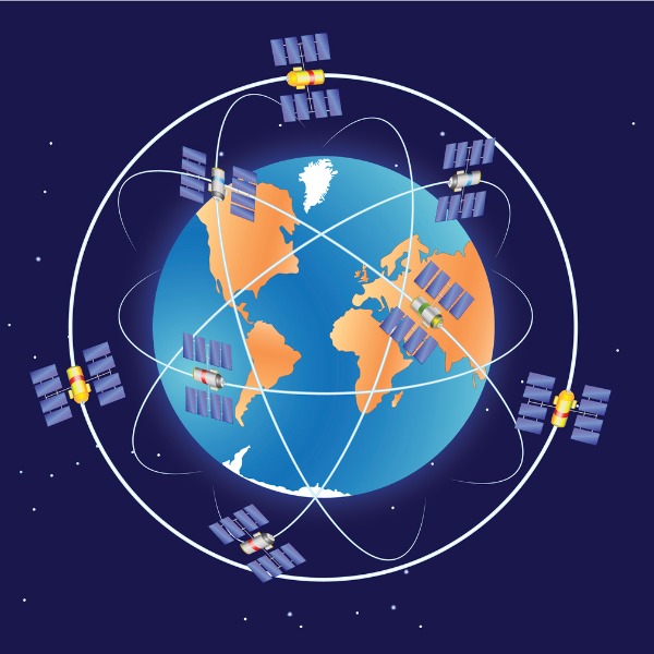
Satellites orbiting Earth (ttsz, iStockphoto)
Satellites orbiting Earth (ttsz, iStockphoto)
How does this align with my curriculum?
Learn about the history, functions, and types of satellites.
When you look up at the night sky, you can see many things including planets and stars. But did you know that you can also see satellites? Satellites are objects that around a planet or star. Natural satellites are usually moons. But they can also be other solar system bodies. The planets and comets in our Solar System are satellites of the Sun.
In this backgrounder, we are going to focus on another group of satellites - artificial satellites. Artificial satellites are satellites that are built by people.
Did you know?
There are more than 8 000 satellites orbiting Earth and this number is growing. New satellites are launched almost every day!
A Satellite That Changed the Course of History

Image - Text Version
Shown is a colour photograph of a model of the Sputnik I satellite.
The Sputnik 1 satellite was a 58.0 cm-diameter aluminum sphere that carried four whip-like antennas that were 2.4-2.9 m long. The antennas looked like long "whiskers" pointing behind the satellite (Source: NASA)
Even though Sputnik I did not carry any scientific instruments, scientists did learn more about the Earth’s upper atmosphere. They did it by studying how the atmosphere affected the satellite’s radio signals.
Did you know?
Sputnik II, the second satellite in space, was launched on 3 November 1957. It carried the first mammal into space, a dog named Laika.
The success of Sputnik began what is known as the Space Race. During this time, the Soviet Union and the United States accelerated their work on space technologies. In the United States, the National Aeronautics and Space Administration, better known as NASA, was born. Soon, NASA scientists and engineers were able to launch two satellites of their own.
The first US satellite sent up was called Explorer 1. It looked a bit like a miniature rocket. It’s main claim to fame is that it was the first spacecraft to detect the Earth's Van Allen Radiation Belt. This belt is actually a cloud of charged particles that surrounds the Earth. The particles are held in place by Earth’s magnetic field.

Image - Text Version
Shown is a colour photograph of the Explorer 1 satellite atop the Jupiter-C rocket.
The satellite is white and cylindrical in shape. The top of the satellite is pointed but also slightly rounded. The top part of the satellite has pale brown vertical stripes on a white background.
The second American satellite was Vanguard I. It was about the size and shape of a grapefruit. It did not use a battery for power. Instead, it used an important new technology - solar cells. Solar cells allowed satellites to work for much longer than batteries. The cells in Vanguard I worked so well that it is actually still in orbit 60 years later!

Image - Text Version
Shown is a colour photograph of a model of the Vanguard I satellite. A treeline and sky can be seen in the background.
The satellite is a dark metallic colour and is roughly spherical. Coming out the top is a small, cylindrical object. Projecting out from the satellite are six thin rods, which are the antennas.
Since those first satellites, many other countries have launched satellites of their own, including Canada. Alouette I was the first Canadian satellite. It made Canada the third country on Earth, after the United States and the Soviet Union, to design and build its own satellite.
We suggest checking out this cool infographic from NASA if you are interested in learning more about the early history of satellites.
What are satellites used for?
The main roles of satellites are for communication, and observation. Let’s look at each of these in detail.
Satellites and Communication
Satellite communication is useful for when you want to send information quickly across the world. Satellites have several advantages over land-based communication systems. For example, satellites can allow people in isolated or remote areas to have Internet and cell phone service. This includes people like researchers working on ships on the open ocean or Antarctica. It is also useful if you are out in a place where signals from cell phone towers don't reach!
In order to have uninterrupted communications, a group of satellites can work as a. This is called a satellite constellation. For example, the Iridium NEXT system that provides global Internet and cell phone coverage is made up of 66 satellites.
SpaceX's Starlink satellite constellation was created with the goal of providing internet coverage to the entire planet. This group of over 1 600 satellites will provide internet to many people who have never had it before, allowing them access to things like education for the first time.

.jpg)
Image - Text Version
Shown is a colour photograph of a group of Starlink satellites as they are being deployed in space. The Earth, as seen from space, fills most of the background.
The satellites look a bit like tracks on a tank.
Did you know?
Some people thought they had seen UFOs when Starlink satellites formed a trail of lights across the night sky in May of 2021.
Satellites can also be used to help us communicate with people and devices in space. They can signals from Earth to spaceships and to robots like the rovers on Mars. Having a communication system that is not impacted by conditions on Earth is a very useful way to make sure that messages will get through.
Satellites and Navigation
Satellites are an important technology for helping people know where they are on Earth. By using multiple satellites, together with receivers, people can determine their location. The first navigational satellite constellation, the American Global Positioning System () system, is made up of 24 satellites. Satellite receivers are now found in many vehicles such as planes, ships and cars. They are also inside most cell phones. Think of the last time you used a map to figure out where you were. Was it a paper map? Probably not! You likely used a map app that was connected to the GPS in your phone.
Did you know?
Satellite systems that cover the whole globe are known as Global Navigation Satellite Systems (GNSS).
Satellites and Observation
Being up so high gives satellites a great view of Earth. This is why some satellites are designed to collect data about the surface of Earth and its atmosphere. These satellites often have powerful cameras and magnification technologies that let them zoom down to see objects as small as 41 cm from thousands of kilometers above! Images taken by satellites are used for many things, from assessing the health of crops to monitoring coastal erosion. Weather satellites are especially useful because the images they take help meteorologists make weather forecasts as well as provide information about potentially dangerous situations, such as hurricanes, and forest fires.

Image - Text Version
Shown are two colour photographs. The photo on the left shows a satellite view of an agricultural area and the photo on the right shows a satellite above the Earth.
In the photo on the left, we appear to be seeing an approximately square grid divided by pale coloured lines. Within the grid, the squares are shaded in different colours of browns, yellows and greens. The light or medium brown areas are likely fields that are not growing crops. The bright or dark green areas are likely fields with crops or forests. The yellowish areas may be growing wheat.
In the photo on the right, is a weather satellite. It has two large outstretched banks of solar panels, coming off the main part of the satellite like wings. In the background is a view of the top of the Earth. Swirls of white clouds are visible. Behind the Earth is the dark blue of space. Coming in from the upper right and reflecting off the panels is light from the Sun.
But satellite cameras are not always pointed at Earth. In fact, the majority of telescopes sent into space to study the Universe are orbiting Earth on satellites.
We recommend you read more about how Canadian satellites are used as scientific instruments, such as in the fight for climate change.
Are “spy satellites” real?
Yes! What some people call “spy satellites,” others call reconnaissance satellites. These are communication or observation satellites used by the military and intelligence agencies to get information about other countries. About a fifth of all satellites belong to the military and are used for spying.
Where do satellites orbit?
Where a satellite orbits has a lot to do with its function. There are three main regions where satellites orbit. These are known as Low Earth Orbits, Medium Earth Orbits and Geosynchronous Orbits.
Low Earth Orbit (LEO)
Low Earth Orbit (LEO) is the easiest orbit to get satellites to follow and the majority of satellites are in the LEO “corridor.” This is an area between 160 km and 1 000 km above the Earth’s surface. For comparison, commercial aircraft don’t tend to fly higher than 14 km above the ground. Since these satellites are the closest to Earth, they get the best high-resolution photographs. This is why many weather and scientific satellites are in Low Earth Orbit. LEO is also where you will find the orbit of the International Space Station (ISS). A special type of LEO is a Sun-synchronous Orbit (SSO). These orbits align with the Sun. As a result, SSO satellites visit the same spot on Earth at exactly the same time, everyday. Satellites with SSO are useful for weather and reconnaissance missions because they can spot changes that happen in a place from day to day. Most SSO satellites orbit at altitudes of 600 to 1 000 km.
The advantage of LEOs is that their signals are strong, since the signals do not need to be sent far. Their signals also do not take long to reach Earth. LEOs also can follow many different paths around the Earth. One disadvantage of LEOs is that each satellite does not cover a lot of the Earth on its path. Another is that they experience wear and tear from the molecules in Earth’s atmosphere. The molecules of the Earth's atmosphere also slow the satellite down. Once it no longer goes fast enough to orbit, it re-enters the Earth's atmosphere and burns up. The higher a satellite orbits the Earth, the longer it will stay in space. Some satellites have small rocket motors that they use to boost them into higher orbits so they can stay in space longer.
Did you know?
The International Space Station is Earth’s biggest (and most fascinating) artificial satellite!

Image - Text Version
Shown is an illustration of the locations of typical satellite orbits relative to the Earth. The orbits are drawn to scale.
In the centre of the illustration is an image of the Earth.
Surrounding the Earth is a fairly narrow pale blue region. It is about a quarter the width of the Earth. This indicates where Low Earth Orbits are located. Within this region is a red dotted line that is fairly close to the Earth. This line indicates the location of the orbit of the ISS. The height of this orbit is between 370 and 460 kilometres.
Beyond the blue area is a much larger yellow area. Its width is about two and a half times the size of the Earth. This indicates where Medium Earth Orbits are located. Within this region is a green dotted line that is about midway between the Earth and the outer part of the yellow area. This line indicates the location of the orbit of GPS satellites. This orbit is around 20 200 kilometres.
Surrounding and just past the yellow area is a dotted black line. This line indicates the location of geosynchronous orbits. This orbit is at 35 786 kilometres.
Medium Earth Orbit
Medium Earth Orbit (MEO) satellites are found higher than LEOs but lower than satellites in High Earth Orbits (HEO). Satellites with MEOs follow many different paths around the Earth. MEOs are common for navigation satellites such as the GPS satellite constellation. An advantage of MEOs over LEOs is that they can cover more of the Earth. The disadvantages are that they have weaker signals and their signals take longer to reach Earth.
Geosynchronous Orbit and Beyond
At an altitude of 35 786 kilometres is the location of Geosynchronous Orbits (GEO). The “geo” means “Earth” and the “synchronous’ means “happening at the same time.” The orbits of GEO satellites match the Earth’s rotation. Geostationary orbits are a type of geosynchronous orbits. Geostationary orbits align with the. Orbits above the level of GEO are known as High Earth Orbits (HEO).
The advantage of satellites with GEOs is that they stay over the same spot on Earth all the time. And because they are out so far, they tend to be able to stay up in space for a really long time. The downside of GEO satellites is that their signals take the longest to reach the Earth and they can be expensive to build and launch.
Did you know?
The closer a satellite is to Earth, the faster it needs to travel to stay in orbit.
The table below has further information about common satellite orbits.
| Orbit | Altitude (km) | Approximate Speed (km/h) | Time per Orbit |
Orbits/ day |
Functions |
|---|---|---|---|---|---|
| Low Earth Orbit (LEO) | <1 000 | 28 000 | 90-128 minutes | 11 + | Earth observation, Weather |
| ISS | 370 - 460 | 27 580 | 90 - 93 minutes | 16 | Earth observation |
| Medium-orbit (MEO) | 2 000 - <35,786 | 11 000 - 28 000 | 2-24 hours | 1-12 | Navigation, communication, Earth observation |
| GPS constellation | 20 200 | 14 000 | 12 hours | 2 | Navigation |
| Geosynchronous Orbit (GSO) | 35 786 | 10 800 | 23 hours, 56 minutes, and 4.09 seconds | 1 | Communication, Weather, Navigation |
Did you know?
Only once have two satellites crashed into each other!
What are the parts of a satellite?
The technology inside a satellite depends on its function. But all satellites have some things in common.

Roll-up solar array (Source: NASA)
Image - Text Version
Show is a gif of a solar array unrolling in space. In the background, clouds far below in the Earth's atmosphere move from right to left.
The base of the array is attached to an arm connected to the satellite. A thin sheet of solar panels is fixed to the base. The sheet of panels looks a bit like a scroll of shiny metallic paper. The other end of panels is wound around a roller. Two telescoping arms connect the roller to the base. As the telescoping arms extend, the solar panels unroll.

Image - Text Version
Shown is a photograph of a Landsat 9 satellite. One of the sides has been removed so that part of the interior of the satellite is visible. The satellite is supported on the floor of what could be a warehouse space.
The satellite is fairly box-shaped. One of the exterior sides is covered in shiny, black solar panels. The front of the satellite has had its outer surface removed. Inside is what looks like a jumble of objects wrapped loosely in aluminum foil. The hinged top surface of the satellite has been opened to reveal more angular objects wrapped in aluminum foil.

Image - Text Version
Shown is an illustration of the US Navy MUOS satellite in space.
The satellite has a squat cylindrical section in the centre that is white. On opposite sides and connected to the central part with wiring are two rectangular solar arrays that have blue panels and white mountings. Above and below the central part are two antennas. They resemble the tops of pale gold umbrellas, without handles, in their open position. The antennas appear to be connected to the central part with thin wires.
Did you know?
The signal sent from Earth to a satellite is called the uplink signal. The signal sent back down to Earth from the satellite is called the downlink signal.
What happens when satellites stop working?
Like other machines, sometimes satellites stop working. But with no one in space to fix them, what happens? This depends on their altitude. A satellite in LEO can be sent a message to slow down. When this happens, it stops orbiting and falls through Earth’s atmosphere where it burns up. A satellite in a HEO can be sent a message to speed up. When this happens it can escape its orbit and fly off into outer space. Until either of those things happens, broken satellites keep on orbiting. In fact, more than half of the satellites currently in orbit don’t work! These, and other pieces of useless space debris are known as space junk.
A Quick Look Into the Future
So what’s in store for the future of satellites? For one thing, even more satellite constellations. Some experts estimate that by 2030, more than 100 000 satellites could be orbiting the planet. That number may leave you with questions like, how many satellites is too many? Will it still be possible to observe stars at night with all the light pollution from satellites? Or even more importantly, how will people control all that traffic around the planet and make sure satellites don’t crash into each other? These are definitely questions that scientists and governments are looking into.
Satellites of the future will also be more sustainable. As space travel becomes cheaper and more common, it may be more effective to repair or upgrade satellites in space. This would be a great way to decrease the amount of space junk. OSAM-1, which stands for “On-orbit Servicing, Assembly, and Manufacturing,” is a NASA mission that will test an orbiting robot to service satellites.
Check out this video showing the OSAM-1 in action!
Want to see satellites?
It is actually pretty easy to see satellites in the night sky. Satellites look a lot like stars, only with some important differences. Unlike a star, which doesn't seem to move, a satellite moves at a steady pace across the sky in a straight line. Also, unlike stars and aircraft, the light from satellites does not twinkle or blink. The International Space Station looks like other satellites, only brighter! In fact, other than the Moon the ISS is the brightest object in the night sky.
To see what satellites are up there right now, check out this website that mapped the location of about 19 300 human-made objects orbiting Earth. This includes satellites and space junk such as abandoned rocket boosters. You can filter the view in different ways, including by country.
Finally, take a minute to admire Canada’s beauty from a satellite’s standpoint!
Learn More
How Sputnik Launched an Era of Technological Fragility (2017)
This article by the Atlantic looks at our dependence on satellites, how they are important in our modern lives and what could happen if they all stopped working at once.
Satellites in our everyday lives
This page by the Canadian Space Agency has a lot of information about how Canadian satellites affect our lives.
Mathematics of Satellite Motion
This page explains some of the math involved in satellite orbits.
Orbital Mechanics
This backgrounder from Let’s Talk Science has more about the physics involved in keeping satellites in orbit.
References
Chakrabarti, S. (2021, Sept. 25). How many satellites are orbiting Earth? Space.com. Retrieved from https://www.space.com/how-many-satellites-are-orbiting-earth.
European Space Agency (2020, Mar. 30). Types of orbits. Retrieved from https://www.esa.int/Enabling_Support/Space_Transportation/Types_of_orbits
Iridium (2018, Sept. 11). Satellite 101: LEO vs. GEO. Retrieved from https://www.iridium.com/blog/2018/09/11/satellites-101-leo-vs-geo/
Joukowsky Institute (n.d.). 13 Things: Space. Brown University. Retrieved from https://www.brown.edu/Departments/Joukowsky_Institute/courses/13things/7656.html
NASA (2021). Sputnik 1. Retrieved from https://nssdc.gsfc.nasa.gov/nmc/spacecraft/display.action?id=1957-001B
Science Learning Hub (n.d.). History of Satellites - Timeline. Retrieved from https://www.sciencelearn.org.nz/resources/1905-history-of-satellites-timeline.
Singh, P. (2016, Oct. 3). Why Do We Use Microwaves For Satellite Communications? [Online forum post] Quora. Retrieved from https://www.quora.com/Why-do-we-use-microwaves-for-satellite-communications
Than, K. (2007, Oct. 02). The Scientific Legacy of Sputnik. Space.com. Retrieved from https://www.space.com/4421-scientific-legacy-sputnik.html.
Zak, A. (2017, Oct. 04). How Sputnik Worked. Popular Mechanics. Retrieved from https://www.popularmechanics.com/space/satellites/news/a28496/how-sputnik-worked/