7 ways Satellites Help Fight Climate Change
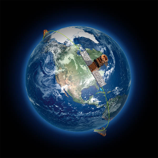
The three RADARSAT Constellation Mission spacecraft (Canadian Space Agency)
The three RADARSAT Constellation Mission spacecraft (Canadian Space Agency)
How does this align with my curriculum?
Discover 7 ways satellite Earth observation helps fight climate change.

Image - Text Version
Shown is an image of the Earth surrounded by text describing 7 ways to fight climate change with satellites. A satellite sits just above the North pole. The ways that satellites fight climate change are the following:
Assess the state of the ozone layer in order to continue protecting it.
Monitor air quality and measure pollution.
Track changes in ice and permafrost conditions.
Provide the authorities with scientific data so that they can make the best possible decisions for the health of our planet.
Protect the integrity of forests and ecosystems.
Monitor soil moisture on a global scale.
Verify the effectiveness of clean-up initiatives.
Here is a riddle for you. What is orbiting hundreds of kilometres overhead that is helping us fight climate change? The answer is satellites! Satellites help us understand how Earth’s atmosphere is changing. They also help us to understand how climate change is leading to floods, droughts, wildfires, melting polar ice caps and rising sea levels.
So what are satellites? Satellites are objects that orbit a planet or star. Earth is a natural satellite to the Sun and the Moon is a satellite to Earth! We also make our own satellites and send them up to space to do a variety of things. Canada has a long history as a global leader in satellites that observe Earth. Here are seven ways this space technology is making a difference in climate action.
Home, sweet, home: Protecting Forests and Ecosystems

Image - Text Version
Shown is a colour photograph of a deer in Jasper, Alberta. The deer is standing in shallow water at the edge of a river. Beyond the river is a forest made up of dark green coniferous trees. Beyond the forest are tall mountains. The sky is cloudy and grey.
The ecosystems on Earth are essential to life: they support many of our basic needs like producing oxygen for us to breathe. But ecosystems and their biodiversity are at risk. This is where satellites come in.
Since 1995, RADARSAT satellites keep an eye on the health of ecosystems by mapping and tracking changes. Beyond their main mission, RADARSAT collects data about changes in forests, tundra, wetlands, coastlines and other protected areas.
Equipped with technology never before used in space, the SMOS satellite maps changes in soil moisture and the of the sea surface. This information helps us understand how climate change affects the .
In 2022, the international satellite, SWOT, will launch. The Canadian instruments on SWOT will help collect precise data about changes in lake and reservoir levels, the discharge of rivers, and the currents in oceans.
Tracking Changes in Ice and Permafrost Conditions

Image-Text Version
Shown is satellite imagery of the Canadian Arctic Archipelago from the Copernicus Sentinel-3 mission. The top left corner is white ice and snow. Towards the top left corner, this white ice fades into a green and brown landmass. The landmass continues towards the bottom of the image, getting greener towards the bottom. Dark inlets of water poke into the landmass. The bottom of the image is a swirl of white clouds.
Getting to the Root of it: Checking Soil Moisture Globally

Image -Text version
Shown is an artist’s conception of the SMOS satellite turned towards the Sun. The satellite has two long arms each with four grey square panels aligned side by side. These arms connect to a smaller tan-coloured cube-shaped central object. Two other tan-coloured arms project sideways from it. The Sun is a bright white circle. A camera flare is simulated using pale orange and red circles. Light emanates from around the Sun into the dark starry background of the image. A sliver of the Earth is at the bottom of the picture. It is made up primarily of a yellow-brown landmass and small areas of blue water.
Scientists believe that soil moisture is half the equation to understanding how climate change affects the water cycle. The other half? Ocean salinity! Not only does SMOS look at ocean salinity, it also looks at soil moisture around the world. It is the first satellite to map both ocean salinity and soil moisture. SMOS is not alone though. The satellite SMAP maps soil moisture too. It also checks on the freezing and thawing of soil in Canadian boreal regions and other cold areas of the world.
Protecting Earth’s Blanket, the Ozone Layer

Image - Text Version
Shown is a 3D rendering of the Earth in space and the ozone layer. The ozone layer appears as a cloudy yellowish-green area spanning the globe near the Equator.
The is a blanket of gases that protects us from harmful solar UV rays. This blanket was thinning for many decades because of the release of gases like . Many of these same gases are also powerful greenhouse gases. Thanks to governments all over the world who agreed to stop production of ozone depleting gases, the ozone layer has started to recover.
Satellites have an important job in monitoring the ozone layer. In fact, Canada is a world leader in studying ozone and greenhouse gases from space. Launched over 18 years ago, Canada’s SCISAT satellite measures ozone and ozone-destroying substances in the Earth’s atmosphere. Out of all the satellites, it actually measures the largest number of trace gases in the world! The Canadian instrument OSIRIS on Sweden’s Odin satellite also measures the ozone layer. They both help us understand how the ozone layer is recovering.
Head in the Clouds: Monitoring Air Quality, Pollution and Clouds

Image -Text Version
Shown is an illustration of the CloudSat Satellite flying over the Earth. The satellite is made up of a cylindrical central structure with a variety of instruments attached to it. This connects to two rectangular arms, each covered by three blue solar panels. Below and to the right of the satellite is a part of Earth. Dark blue ocean and bright green land is visible beneath wispy white clouds.
A breath of fresh air may not be as fresh as it seems. Pollution isn't just limited to the air. Soil, water and more can also suffer from pollution. Energy generation, transportation, manufacturing and waste can all be sources of pollution.
Satellites can look at the sources and movement of pollution, as well as check air quality. The Canadian instrument MOPITT on NASA’s Terra satellite gathers long-term data on carbon monoxide, a major air pollutant from incomplete combustion.
It turns out clouds may affect our climate more than we thought. While other satellites struggle to see through clouds, the CloudSat satellite helps scientists to see clouds in 3D. CloudSat helps us understand how clouds are layered, how dense clouds are, and if they are precipitating (rain or snow). We can also learn how in the atmosphere influence how clouds absorb and reflect light. But that’s not all. SCISAT can measure up to 40 different atmospheric gases. These measurements will help scientists better understand the ozone layer, climate change, air quality, carbon in the atmosphere and pollution.
Our Climate Action Report Card
 in Kanata, Ontario in November 2002")
Image - Text Version
Shown is a colour photograph of a man standing next to the Canadian SCISAT spacecraft during testing at the Canadian Space Agency David Florida Laboratory (DFL) in Kanata, Ontario. The satellite is held up by a white frame. A circular section of the satellite is visible. It is made up of dozens of black rectangles inside of an orange circle. Wires are coming out of the circle at several different locations. They appear to wrap around the white frame. The satellite is about as tall as the man. The man is wearing a lab coat and gloves as well as a protective cap and mask.
Receiving report cards can be nail biting and scary. But knowing how well we are doing is important. The United Nations’ environmental and climate change reports are one way of figuring out how we are doing.
For example, MOPITT helps us see the effect of anti-pollution initiatives such as reducing vehicle emissions. RADARSAT satellites are useful for tracking severe floods and mapping oil pollution in the ocean. With SCISAT’s data, we now know that the 1987 Montreal Protocol, which bans substances that harm the ozone layer, is a success. The ozone layer was thinning more slowly between 1995 and 2000. Now it is showing signs of recovery.
New satellites are now beginning to measure greenhouse gases. These measurements are important for us to monitor how well countries all over the world are doing to reduce greenhouse gas emissions in the effort to stop climate change.
What Do We Do Next?
So how will experts know what to study next? Well, they need to think like they’re playing a board game. Why? Board games are all about strategy. You plan your next move based on previous moves and new information. Satellites do the same! They give scientists data that helps us discuss our next moves. Strategic thinking means that climate action plans can include solutions that are more effective. For example, SCISAT and OSIRIS data plays a key role in some international programs and organizations, such as the European Space Agency's Climate Change Initiative, Intergovernmental Panel on Climate Change, World Meteorological Organization. SMAP data helps with predicting climate change trends so we can adapt. With RADARSAT data, we can improve how we preserve biodiversity and manage forests.
Tackling climate change involves understanding its impacts and adapting to it. This means continuous, up-to-date information on all parts of the Earth. It also means improving the environmental prediction models that help us to forecast weather and project climate changes. Anticipating what will happen is key for making good decisions. And space offers a unique perspective of Earth. Keep an eye out for more Canadian satellites, instruments and science joining the movement!
Let’s Talk Science appreciates the work and contributions of the Canadian Space Agency in the development of this Backgrounder.
 Logo")
About the Canadian Space Agency
The Canadian Space Agency (CSA) is responsible for advancing the knowledge of space through science and using its discoveries for the good of Canadians and all of humanity. The CSA focuses its activities and resources on three main areas:
- Space exploration: Participation in astronaut missions, astronomy and planetary studies, scientific research in space.
- Space utilization: Monitoring of our planet and signs of climate change from space.
- Space science and technology: Development of innovative space technologies and applications used on Earth.
Learn More
RADARSAT Constellation Mission: Finding Solutions For A Better Canada
This video (2:11 min.) from the CSA provides a good overview of the ways in which the CSA’s RADARSAT constellation of satellites provide aid and information for critical, on-the-ground operations in Canada.
The Making of a Satellite
This video (1:23 min.) from the CSA animates the components that make up one of the RADARSAT satellites.
RADARSAT satellite data helps monitor and act against illegal fishing
This video (1:20 min.) outlines one of the ways that RADARSAT satellites provide information to global operations.
SMOS 10 Years in Orbit
This video (5:07 min.) from the European Space Agency provides an overview of the SMOS satellite and the ways in which the data gathered from it has been used, especially in regards to the European Climate Initiative.
References
CSA (2015). Canadian contribution to the Soil Moisture Active Passive (SMAP) mission. Retrieved from https://asc-csa.gc.ca/eng/sciences/smap.asp
CSA (2017). CloudSat: Looking at clouds in 3D. Retrieved from https://asc-csa.gc.ca/eng/satellites/cloudsat.asp
CSA (2017). Measuring atmospheric pollutants. Retrieved from https://asc-csa.gc.ca/eng/satellites/mopitt.asp
CSA (2017). Odin. Retrieved from https://www.asc-csa.gc.ca/eng/satellites/odin.asp
CSA (2019). Frequently asked questions about RADARSAT-1. Retrieved from https://asc-csa.gc.ca/eng/satellites/radarsat1/faq.asp
CSA (2019). Taking action on climate change. Retrieved from https://asc-csa.gc.ca/eng/satellites/everyday-lives/climate-change.asp
CSA (2020). SCISAT. Retrieved from https://asc-csa.gc.ca/eng/satellites/scisat/default.asp
CSA (2021). The Surface Water and Ocean Topography (SWOT) mission. Retrieved from https://asc-csa.gc.ca/eng/satellites/swot.asp
NASA (2022). Terra: The EOS Flagship. Retrieved from https://terra.nasa.gov/
United Nations Environment Programme (n.d.) About the Montreal Protocol. Retrieved from https://www.unep.org/ozonaction/who-we-are/about-montreal-protocol